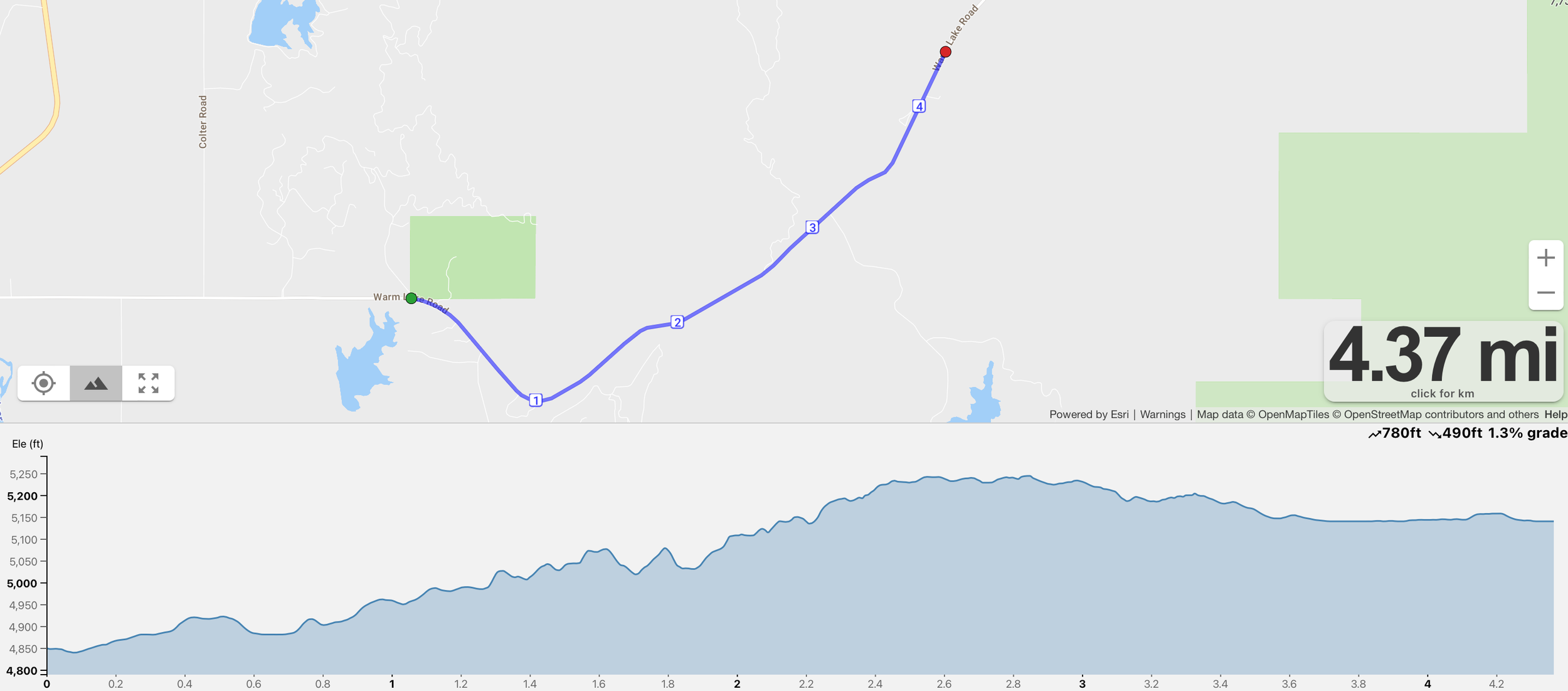
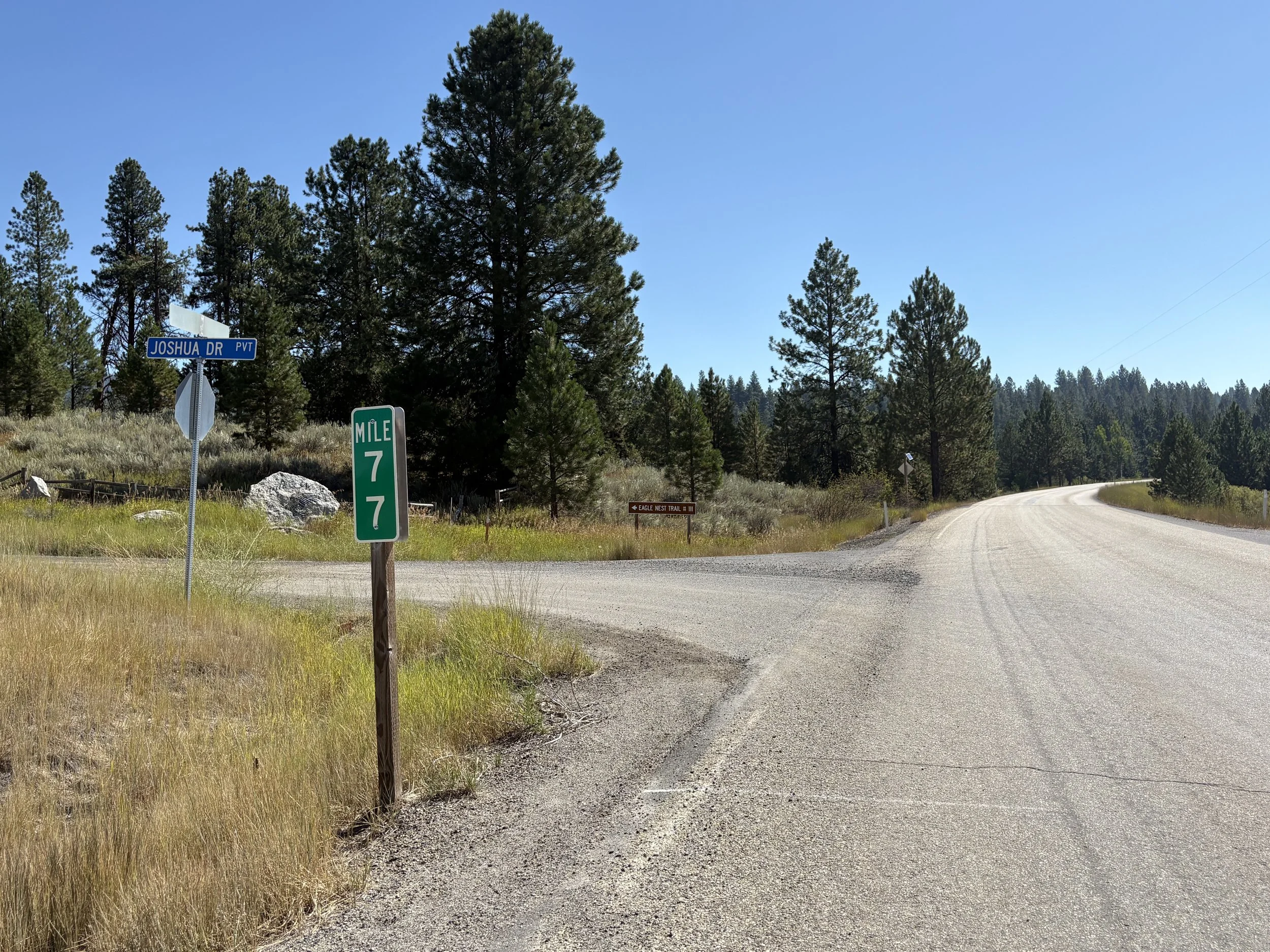
Leg 1 - 4.3 miles
Difficulty - Easy
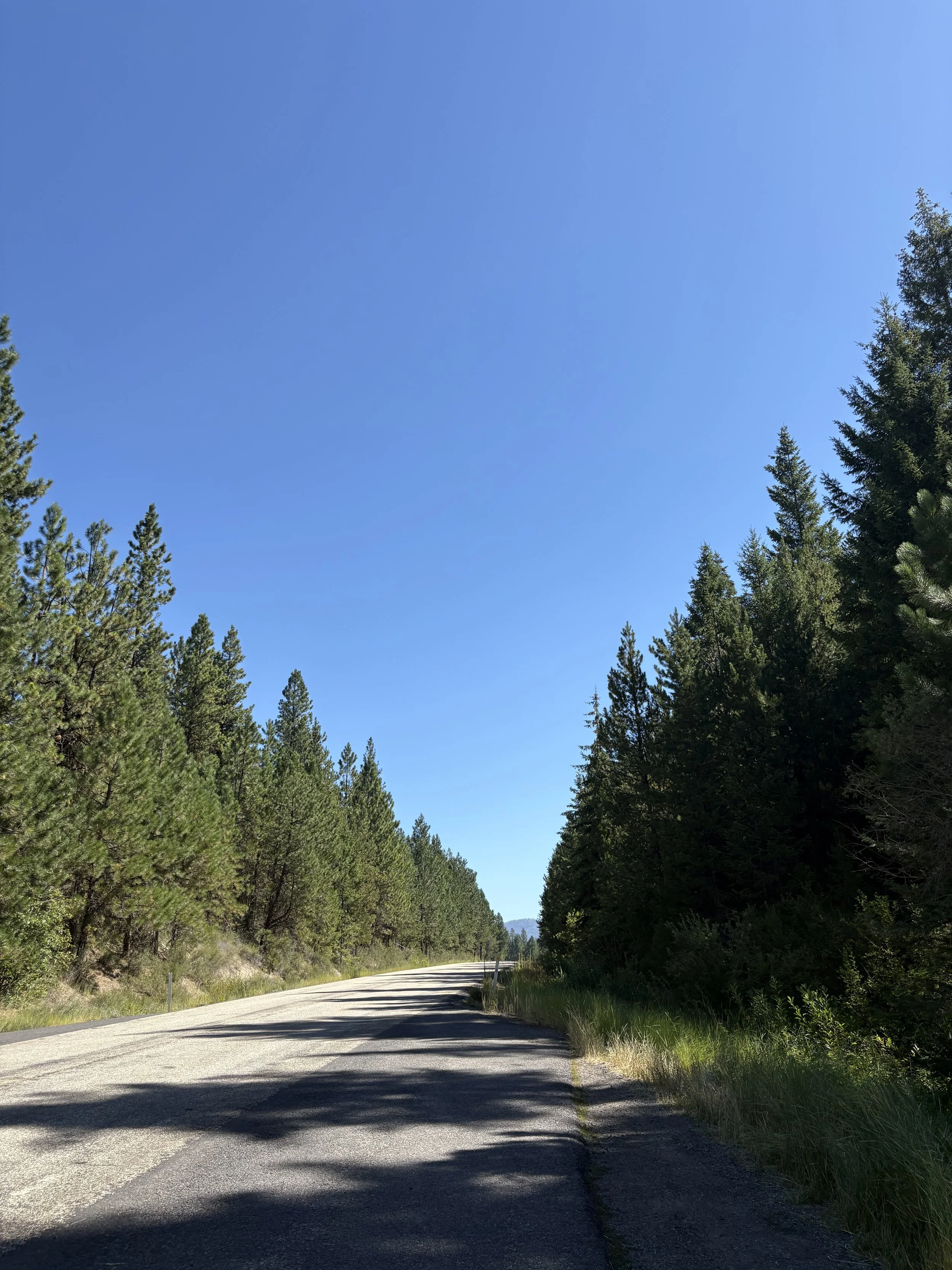
Starting at the pullout on the right side of the road at mile post 77 on Warm Lake Road this smooth, flat 4.3-mile leg is the perfect way to ignite your team’s journey. As the opening stretch of the relay, it’s all about setting the tone—steady, strong, and full of energy. The terrain is friendly and fast, ideal for warming up those legs and finding your rhythm early.
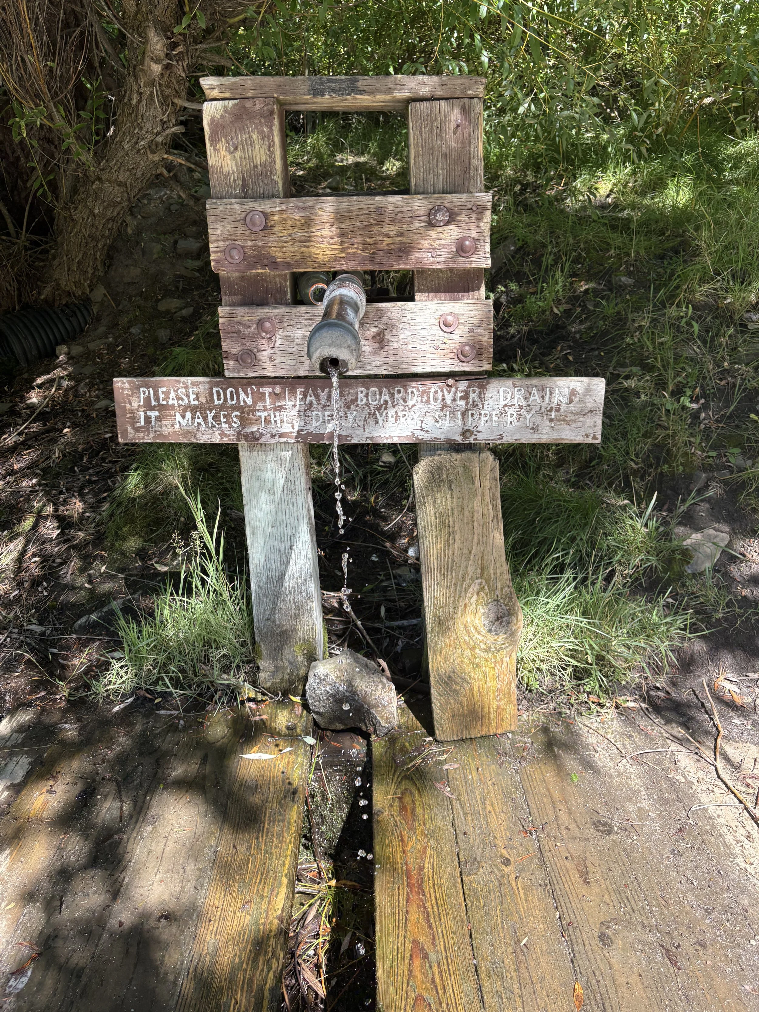
Stay hydrated! Fresh mountain spring water available 2.3 miles in—make sure to stop and fill up.
You’ll feel the buzz of the starting line, the cheers of teammates and spectators, and the excitement of what’s ahead. Whether you're easing into the day or going out hot, this leg offers the perfect blend of adrenaline and control.
Set the pace, soak in the moment, and light the fuse—your relay adventure starts here.
Exchange zone 1 is a large dirt pull off on the right side of the road, no way you can miss it!
Leg 2 - 4.3 miles
Difficulty - Easy
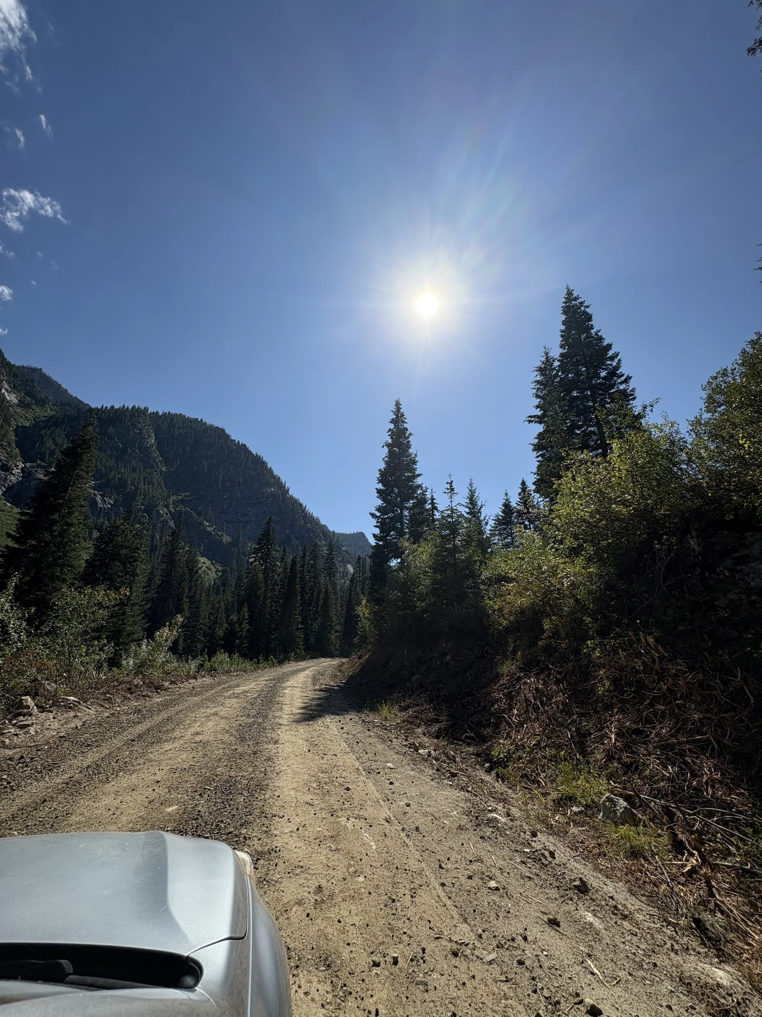
This scenic stretch takes runners through what’s just the beginning of beautiful forests you will adventure, weaving through towering pine and tamarack trees with soft, shaded trails underfoot. The terrain is mostly gentle, with a few rolling sections that keep your legs engaged but allow for a strong, steady pace. As the forest canopy opens up in places, you’ll catch glimpses of the rugged landscape ahead. The leg finishes with a noticeable shift in terrain as the route transitions to the base of the Big Creek Summit climb—offering a moment to regroup before the ascent begins.
Exchange zone 2 is another large dirt pull off on the right side of the road.
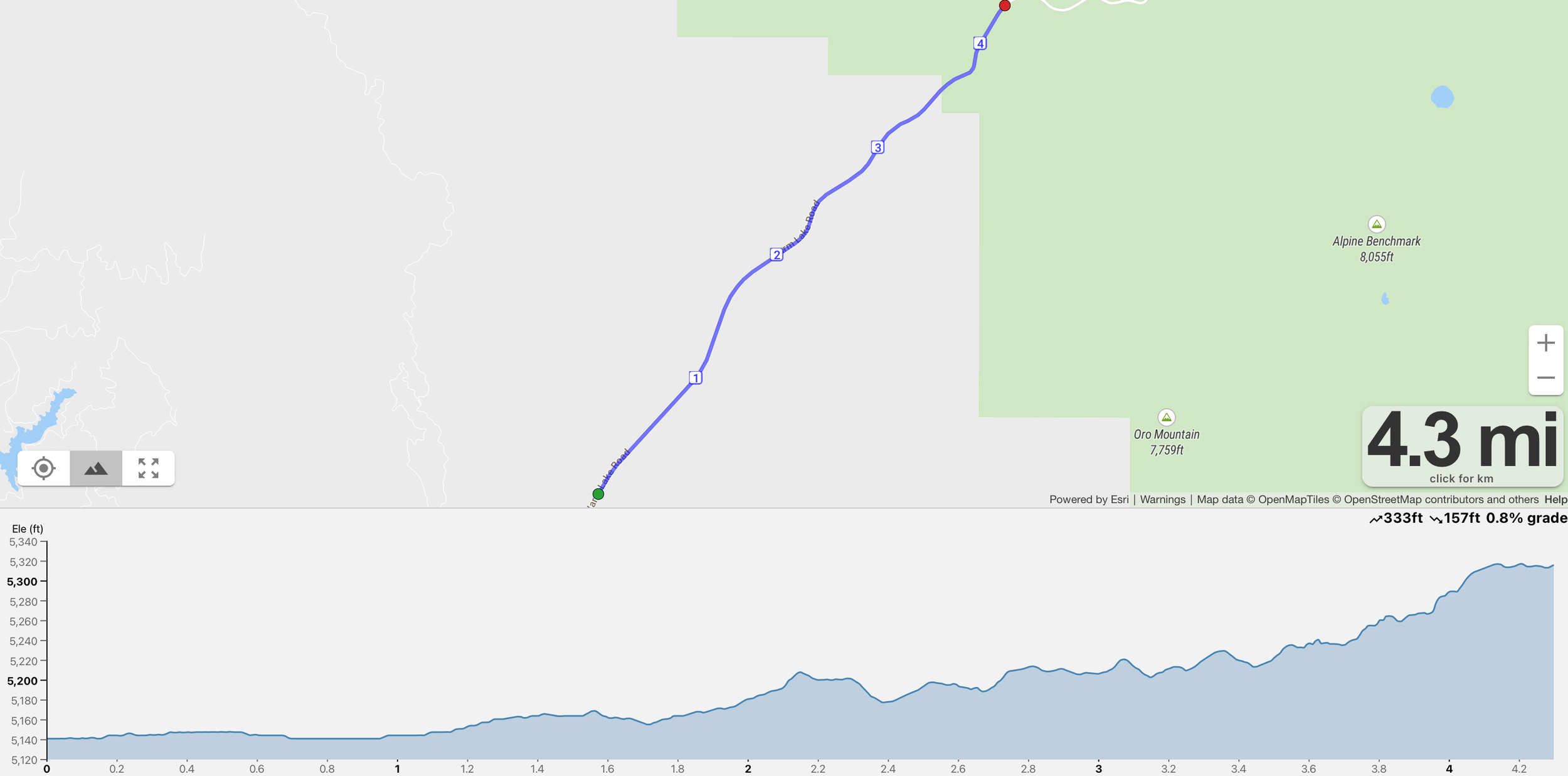
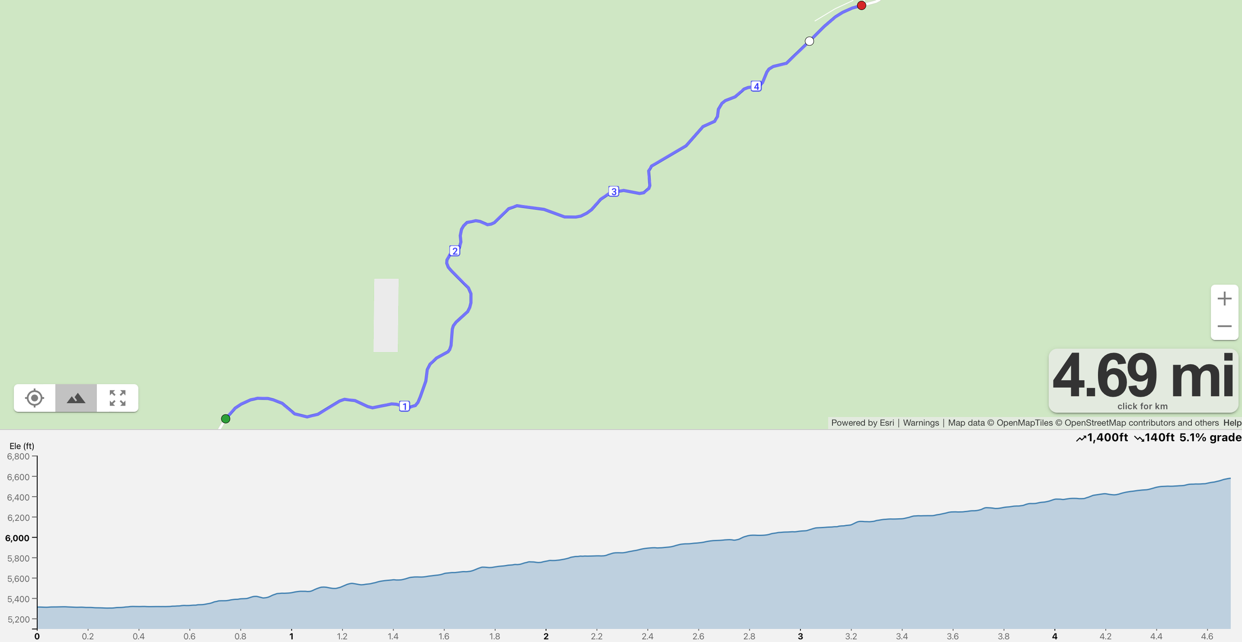
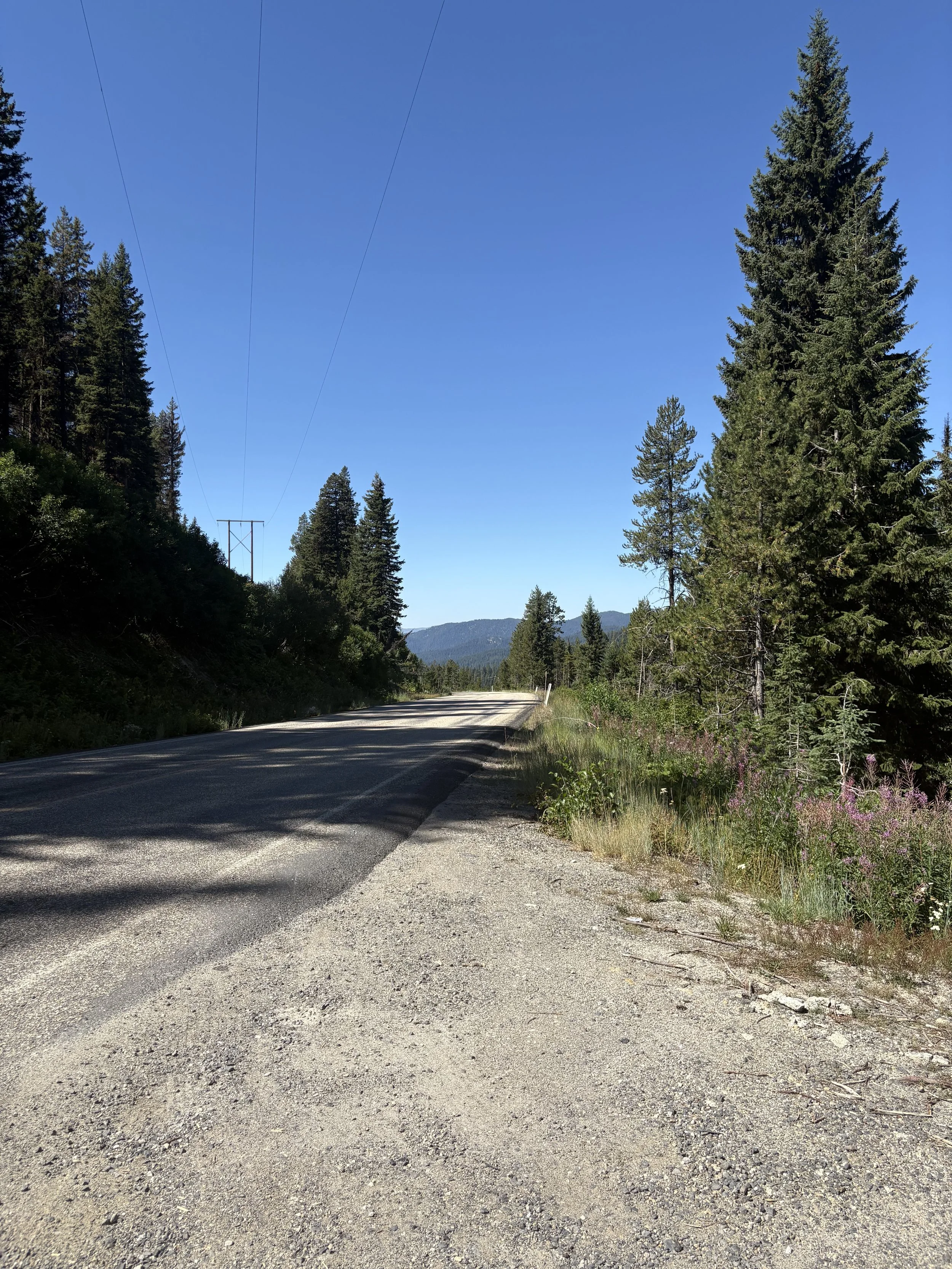
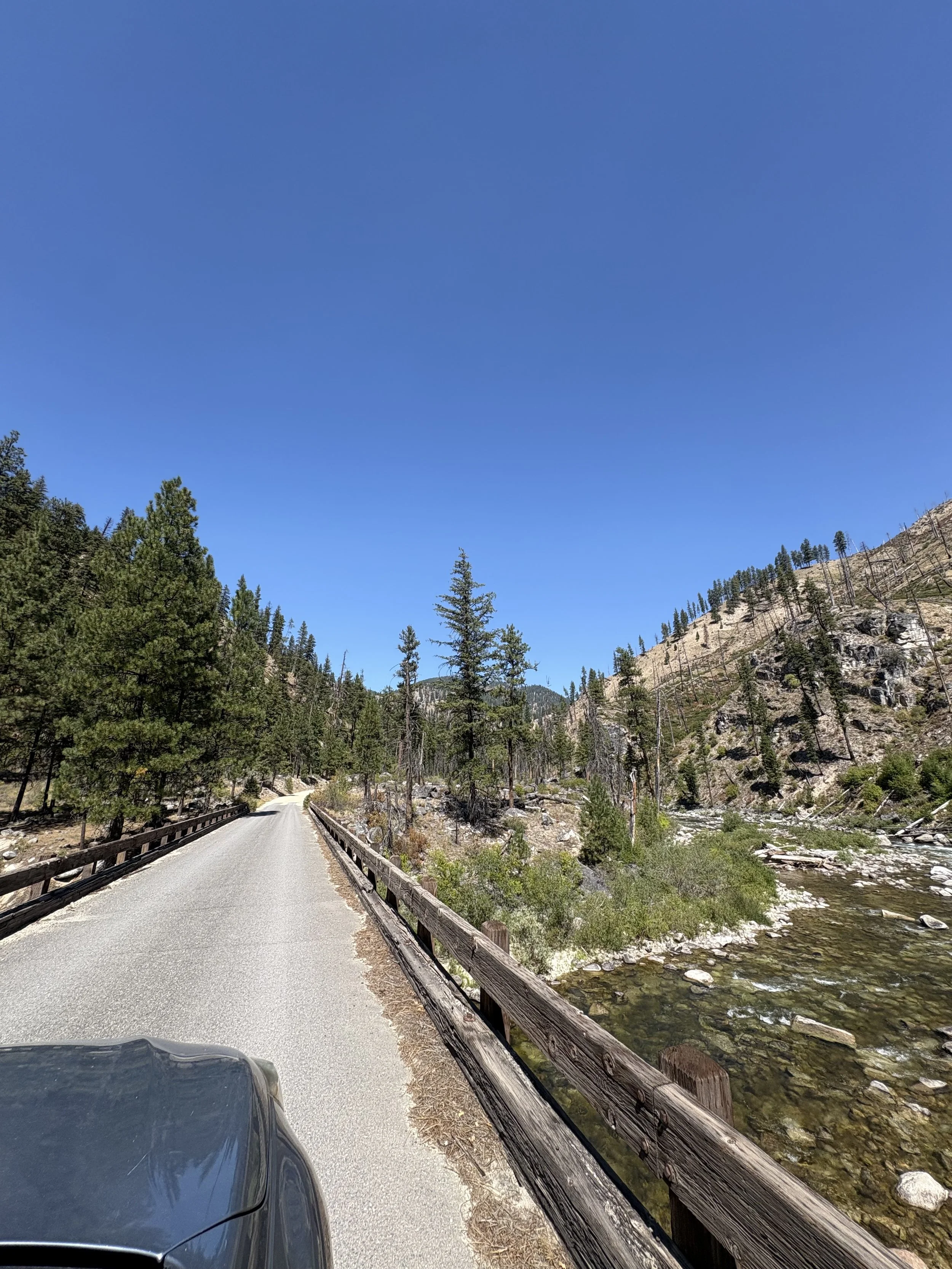
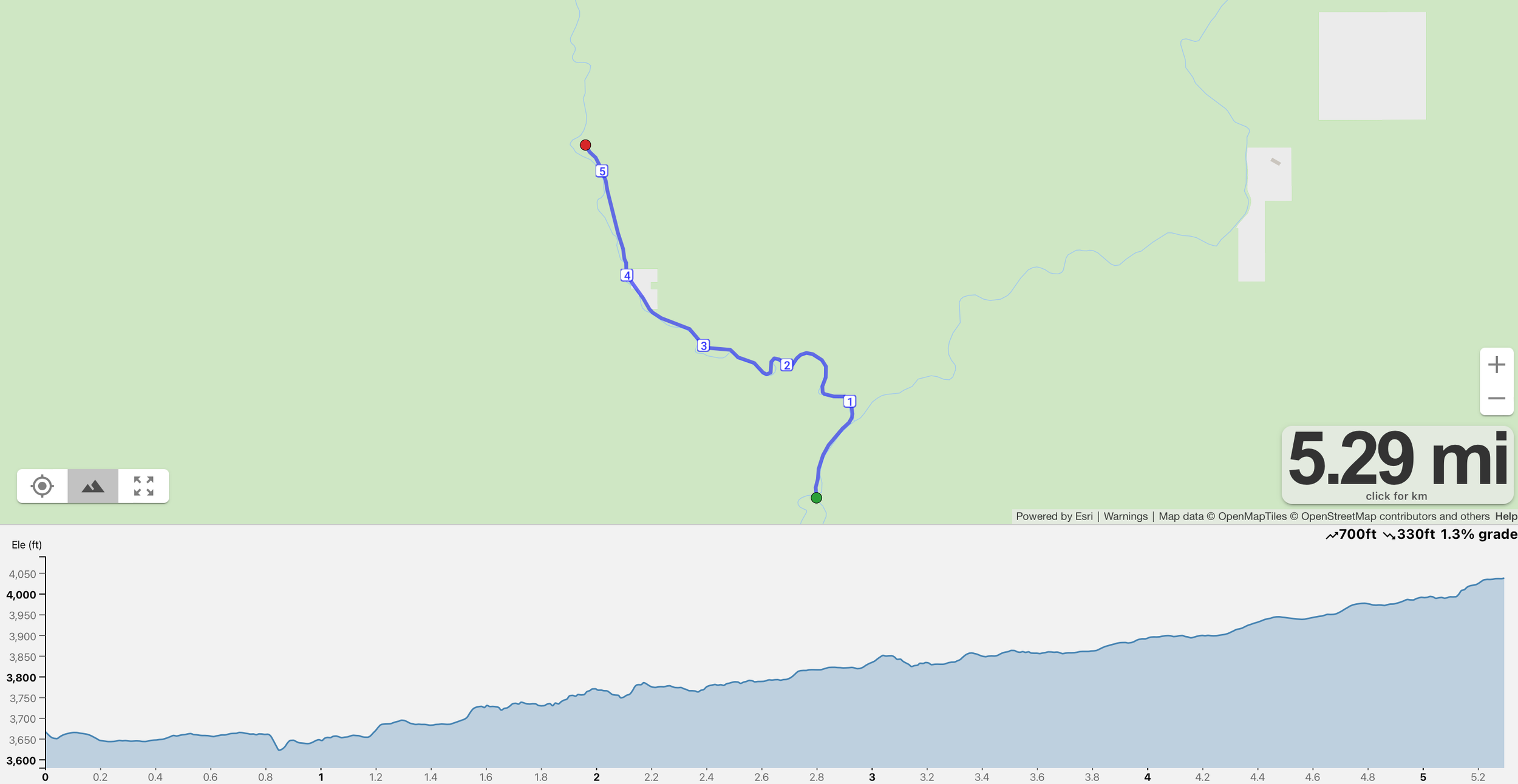
Leg 3 - 4.7 miles
Difficulty - Medium/Hard
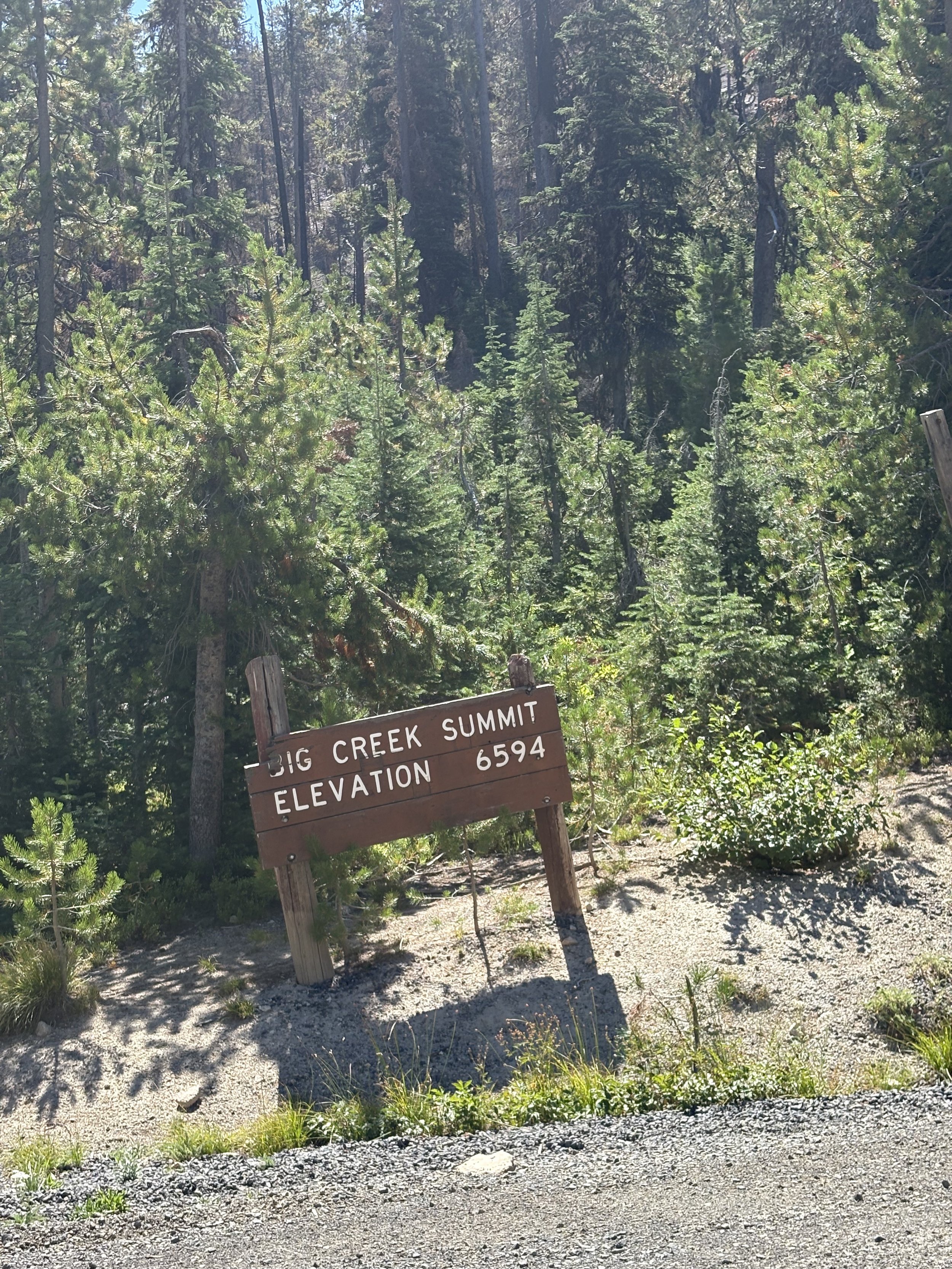
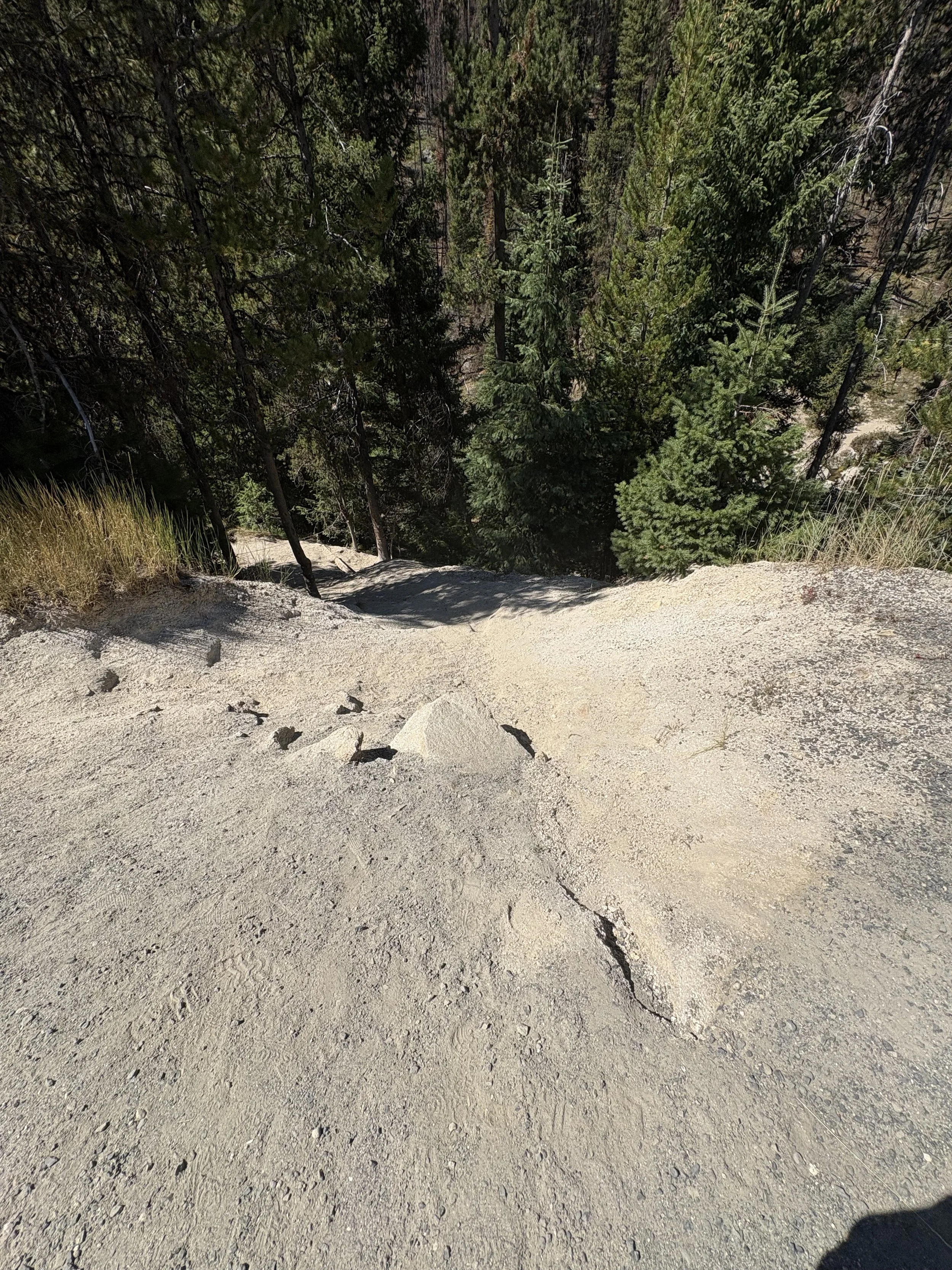
This 4.7 mile leg dishes out a punchy challenge—almost 1,400 feet of steady ascent packed into just under five miles. You’ll dig deep, but the payoff? The summit at Big Creek Summit, offering stellar panoramas that make every step worth it.
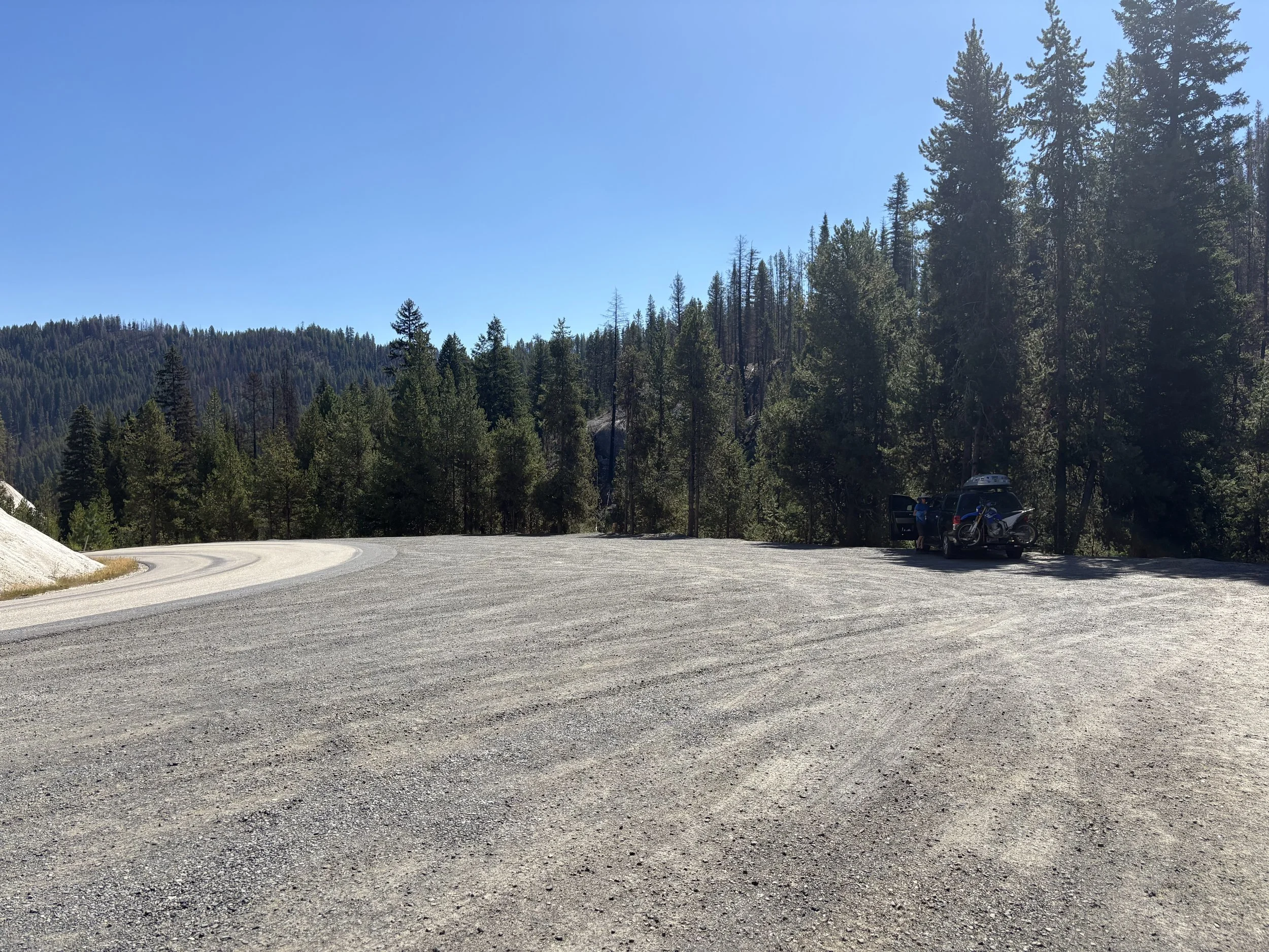
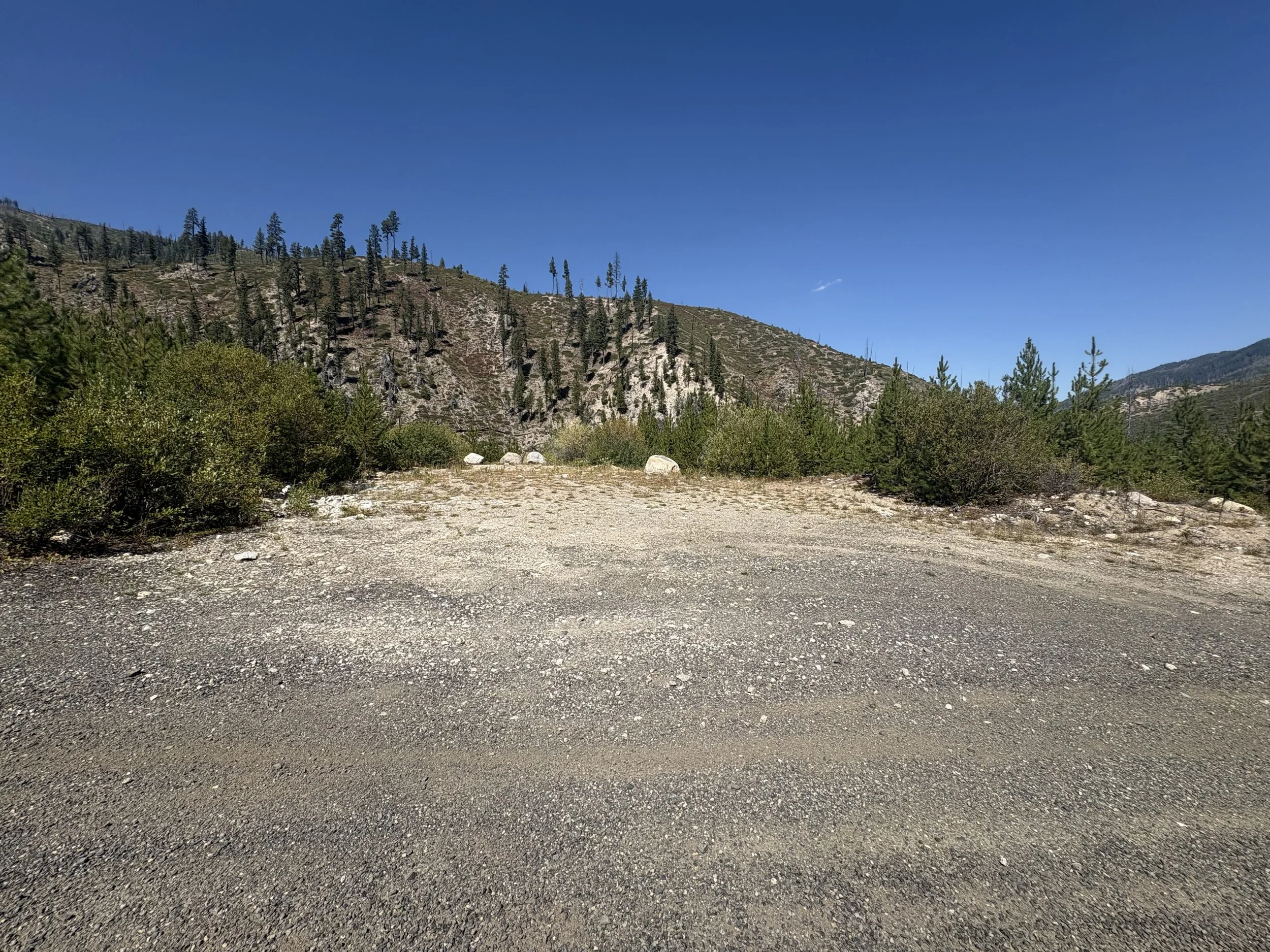
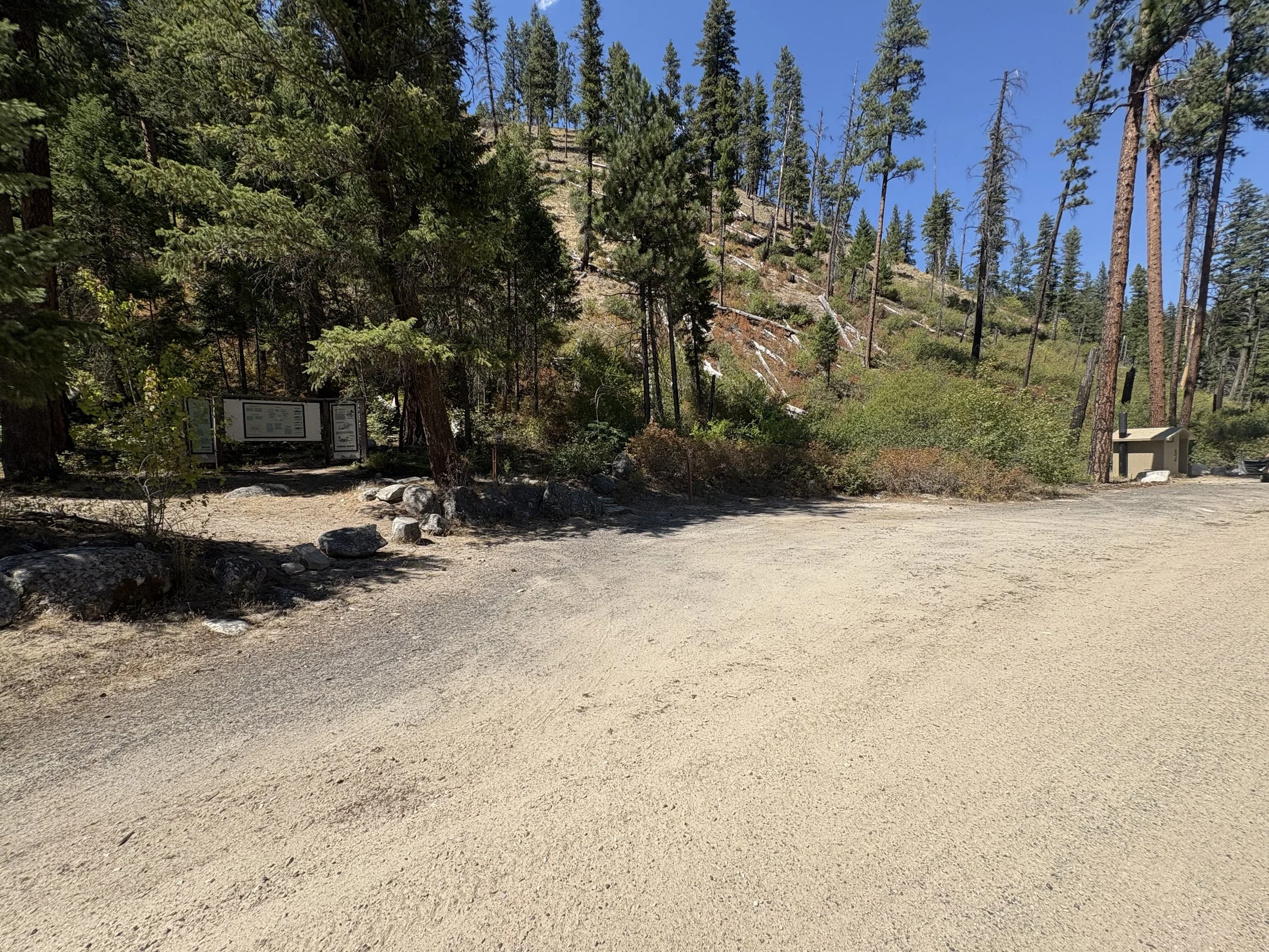
Exchange zone 3 is at the top of the summit on the left side of the road in a large dirt pull out parking lot.
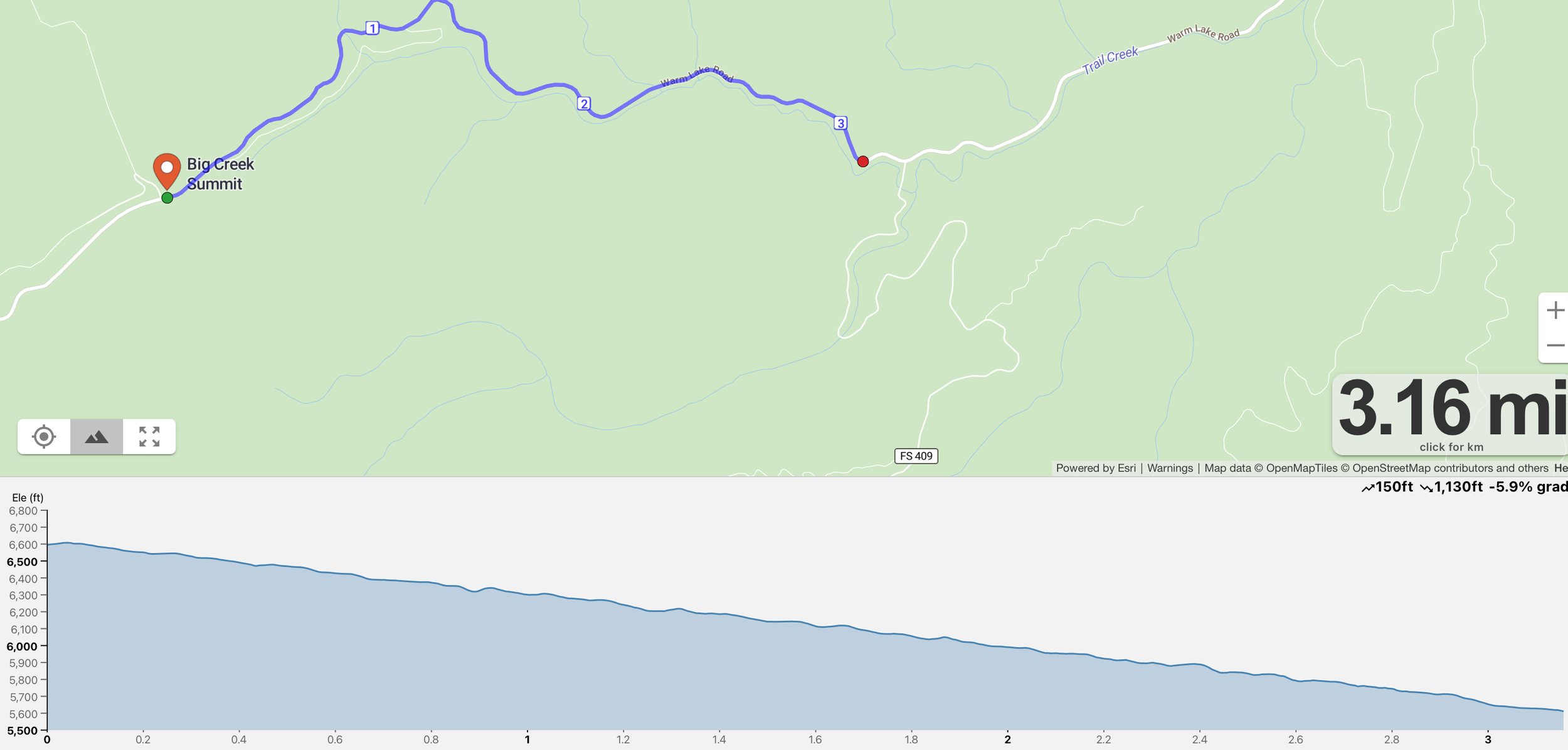
Leg 4 - 3.1 miles
Difficulty - Easy
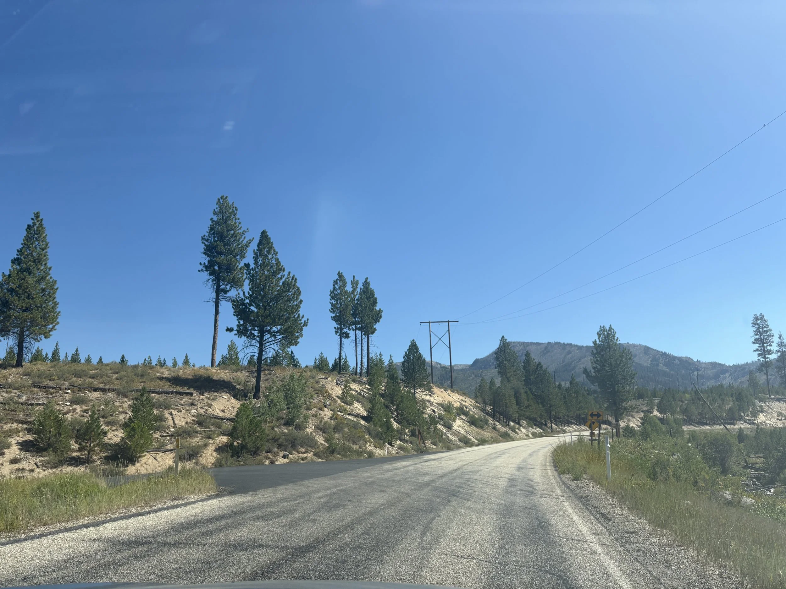
This leg is short, sweet, and built for speed. A winding 3.1-mile stretch of smooth pavement drops steadily downhill, making it one of the fastest—and most fun—legs of the race.
You’ll twist and turn through gentle curves, letting gravity do the work as you cruise toward the exchange. It’s the kind of leg where you can just lean in, open up your stride, and fly.
Exchange zone 4 takes place at the stunning Trail Creek Hot Springs—an ideal spot to recharge. After your run, take a moment to soak in the natural hot springs to loosen up tired legs and ease into recovery. Surrounded by forested hills and the soothing sound of flowing water, it's one of the most scenic—and restorative—spots on the course.
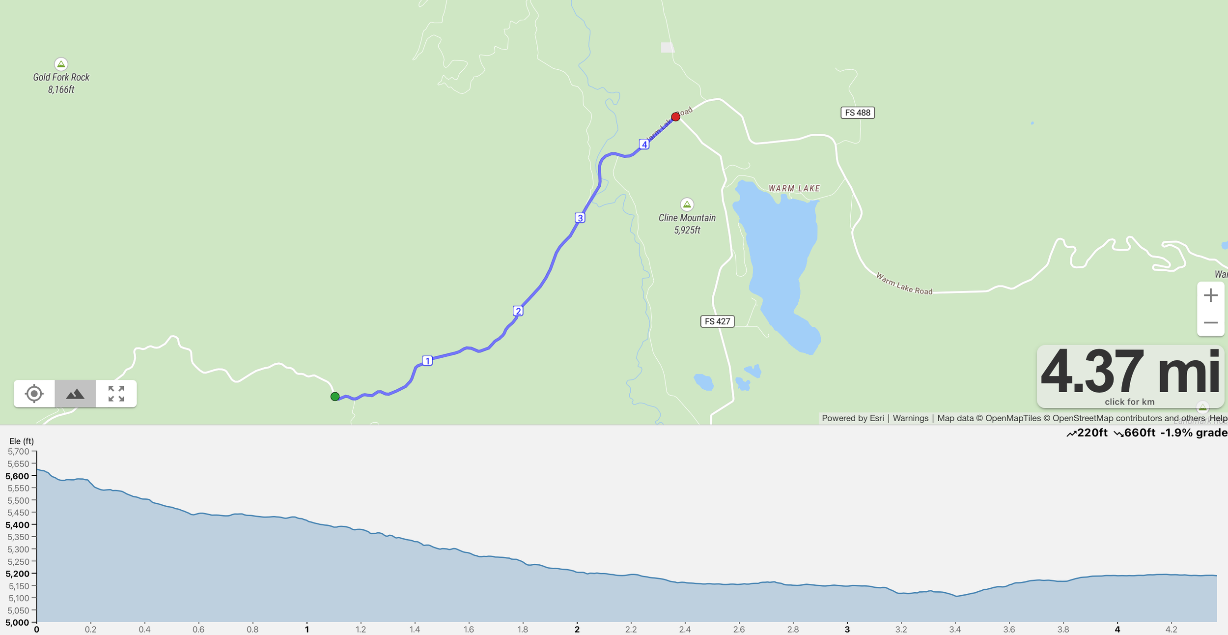
Leg 5 - 4.3 miles
Difficulty - Easy
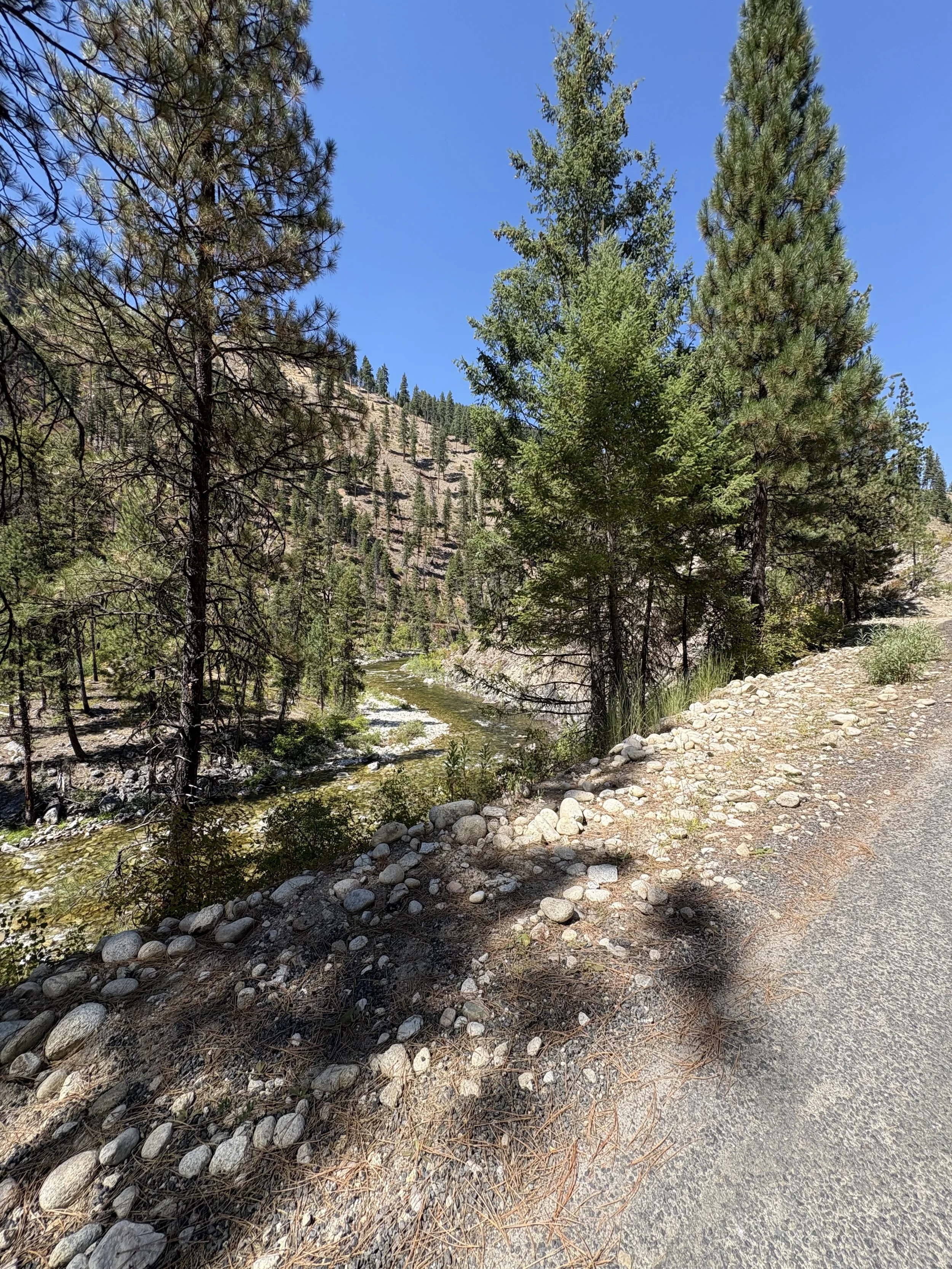
This 4.3-mile leg is a journey through contrast—a gentle downhill that starts tucked in tight curves of winding pavement, then opens up into wide, raw landscapes shaped by fire and time.
You’ll begin your descent flowing through shaded bends, where the road coils smoothly beneath your feet. Then the trees part, and suddenly, you're surrounded by the stark beauty of fire-scarred hillsides and the towering presence of big mountain views. It's humbling. It's powerful. And it’s the kind of stretch that stays with you.
Let the grade pull you forward, breathe in the high-country air, and take in the landscape—both the burn and the rebirth.
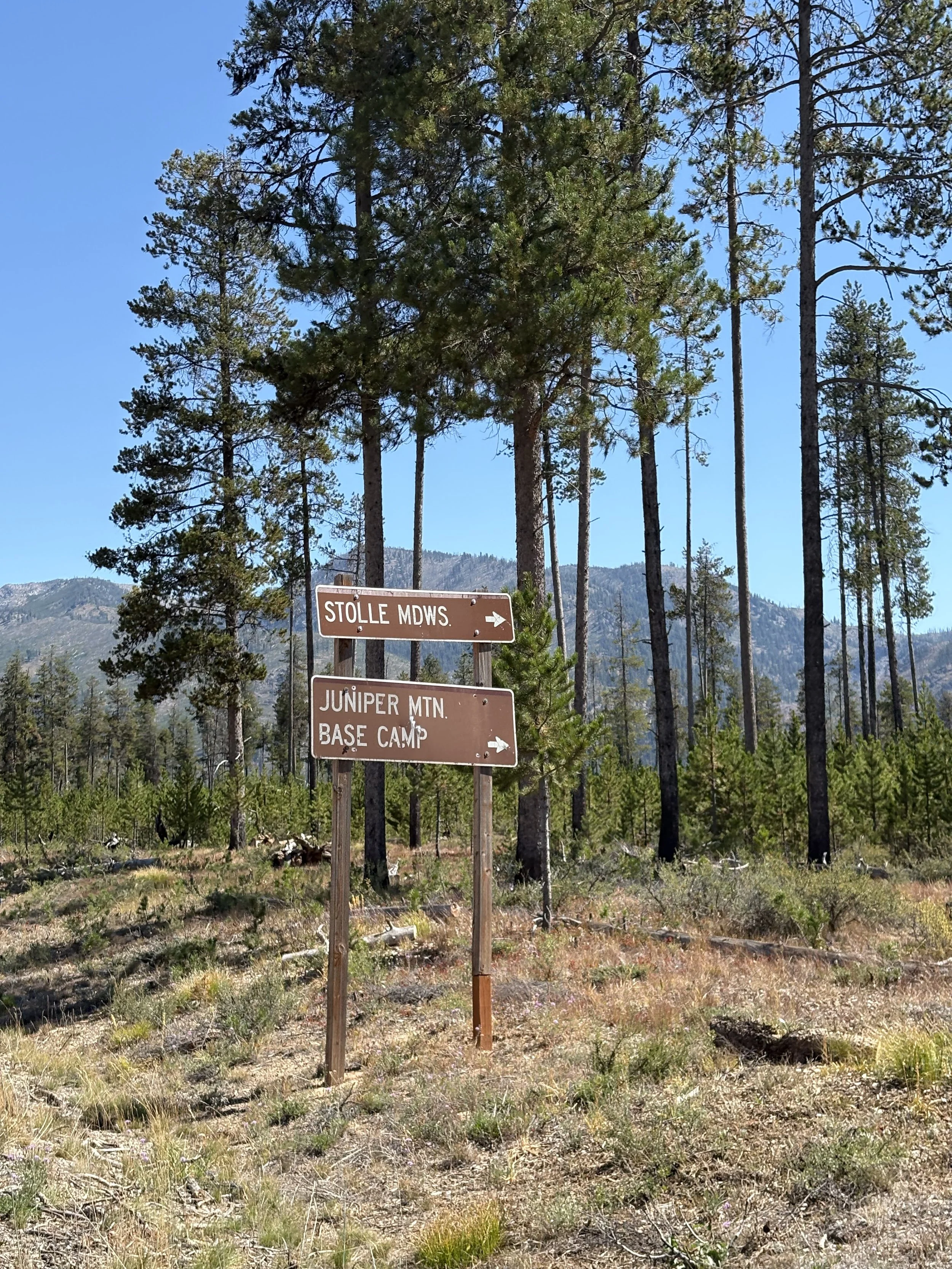
Exchange zone 5 is in the Stolle Meadows pull out on the right side of the road.
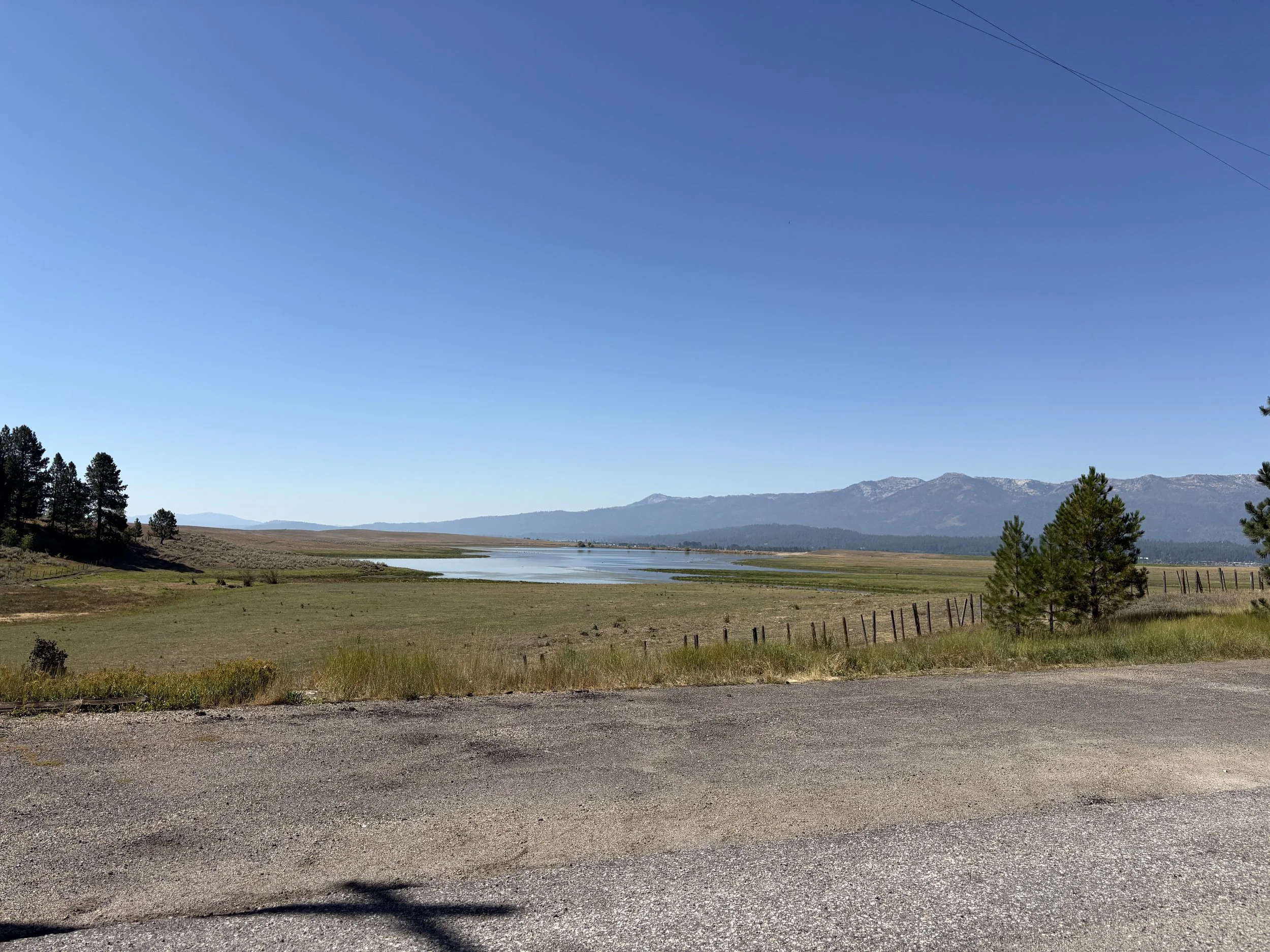
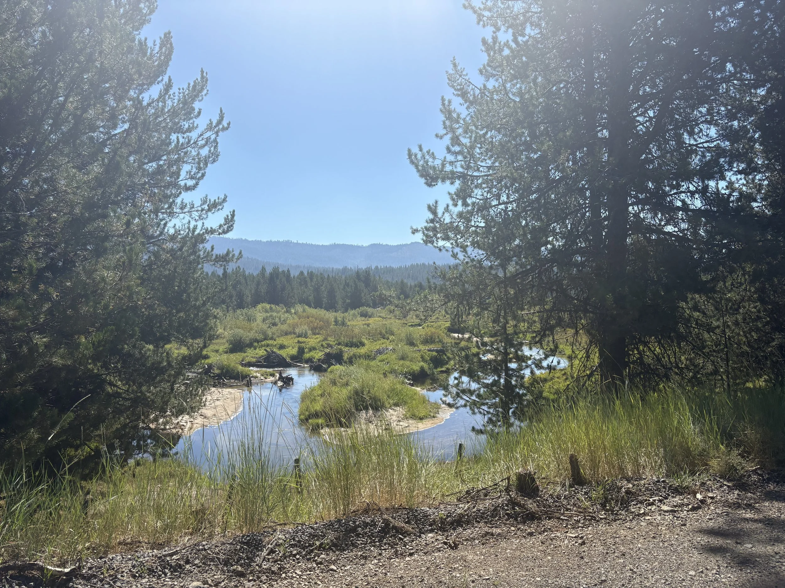
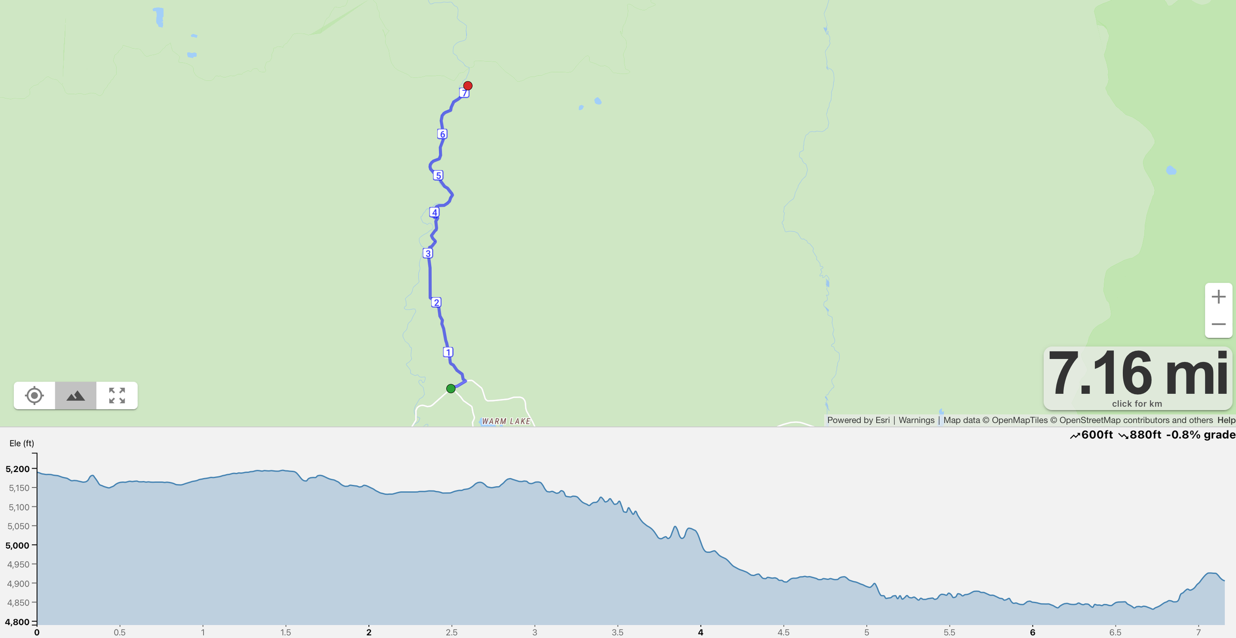
Leg 6 - 7.1 miles
Difficulty - Hard
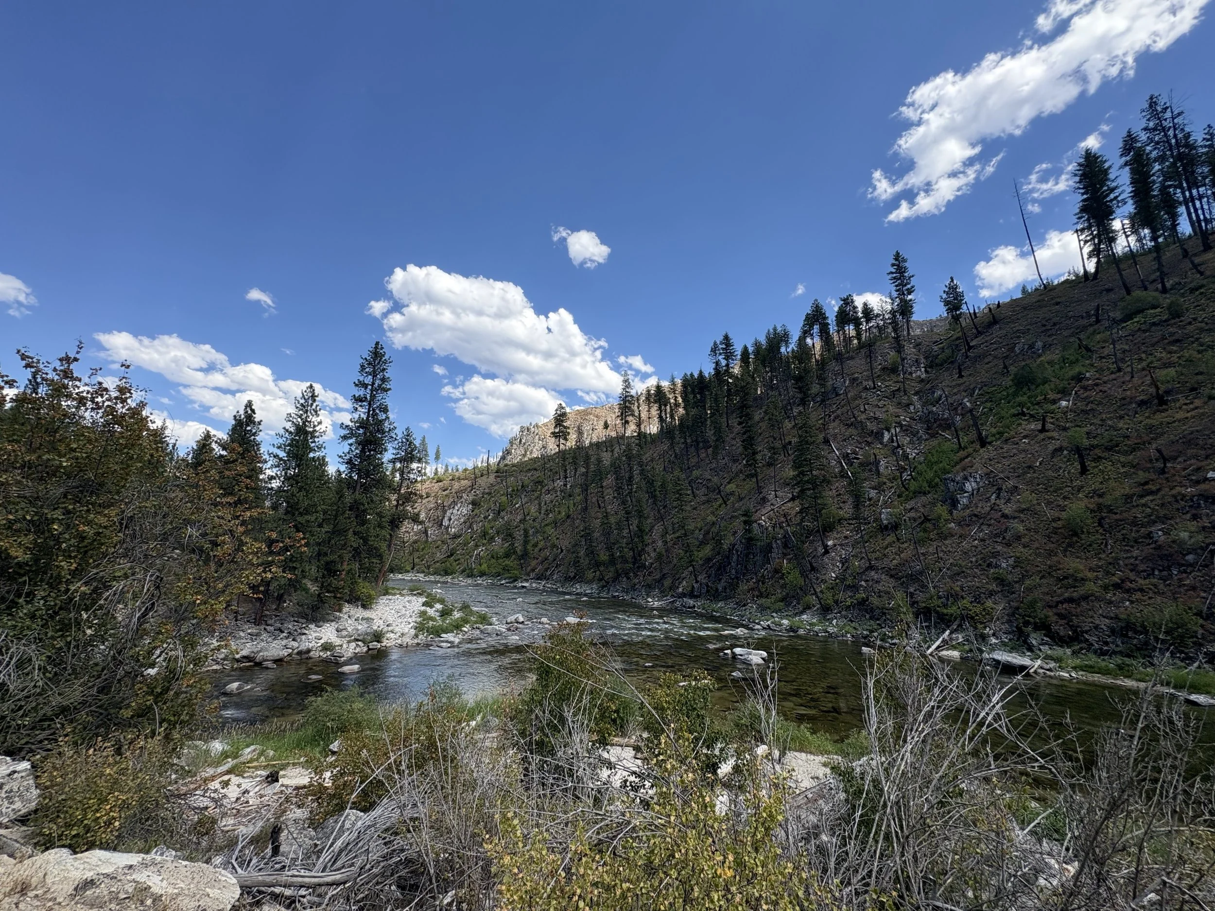
This 7.1 mile is a longer stretch that rewards endurance with stunning scenery. The run begins on a flat section winding through peaceful stands of new-growth pines, where the air is crisp and the trail inviting. As the miles unfold, gentle rolling hills add rhythm and variety to the terrain, keeping the effort steady but manageable. The final section is a runner’s dream—a smooth, gradual downhill descent that opens up alongside the beautiful South Fork of the Salmon River, offering breathtaking views and a refreshing breeze as you approach the exchange.
TURN LEFT 0.2 Miles from start
Exchange zone 6 is a big square dirt pullout on the left of the road.
Leg 7 - 6.8 miles
Difficulty - Medium
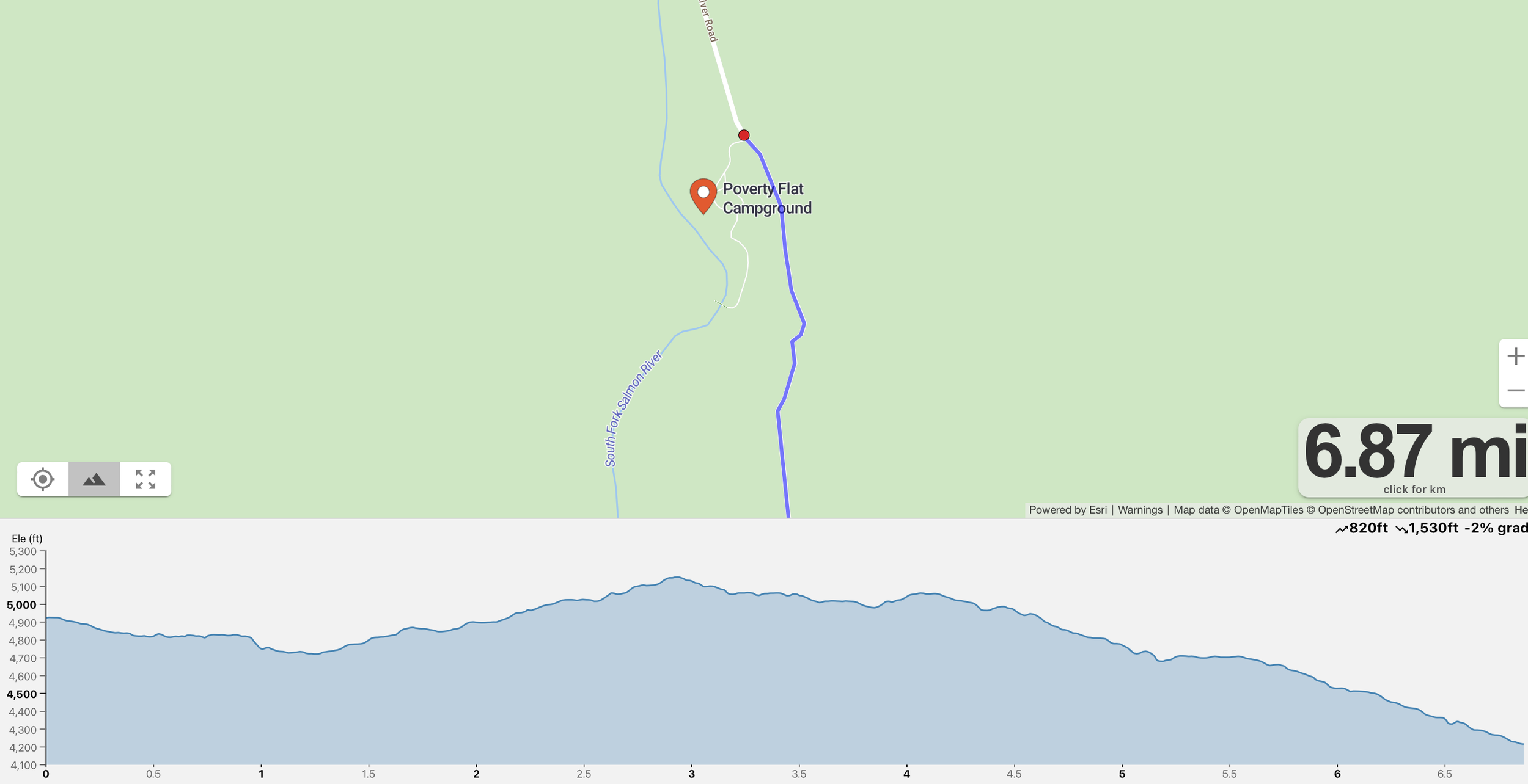
This leg stretches 6.8 miles and offers a long, rewarding descent alongside the South Fork of the Salmon River. The course follows the river’s edge, with cool breezes, forested views, and the sound of rushing water accompanying your stride. Though it's a longer leg, the gentle downhill makes for a smooth, fast-paced run. About 2.8 miles in, there’s a wide pull-out area—perfect for spectators to cheer on runners and soak in the scenery. It's one of the most beautiful and energizing sections of the course.
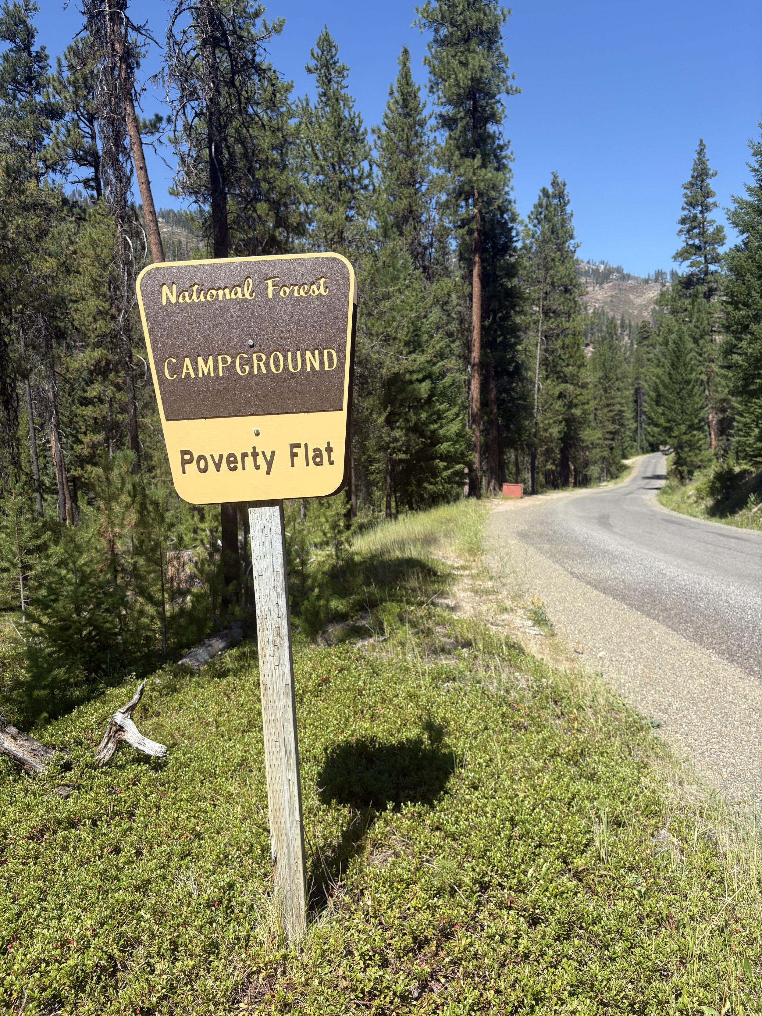
Exchange zone 7 is at Poverty Flat campground. You will need to pull into the campground and park the exchange area will be on the road.
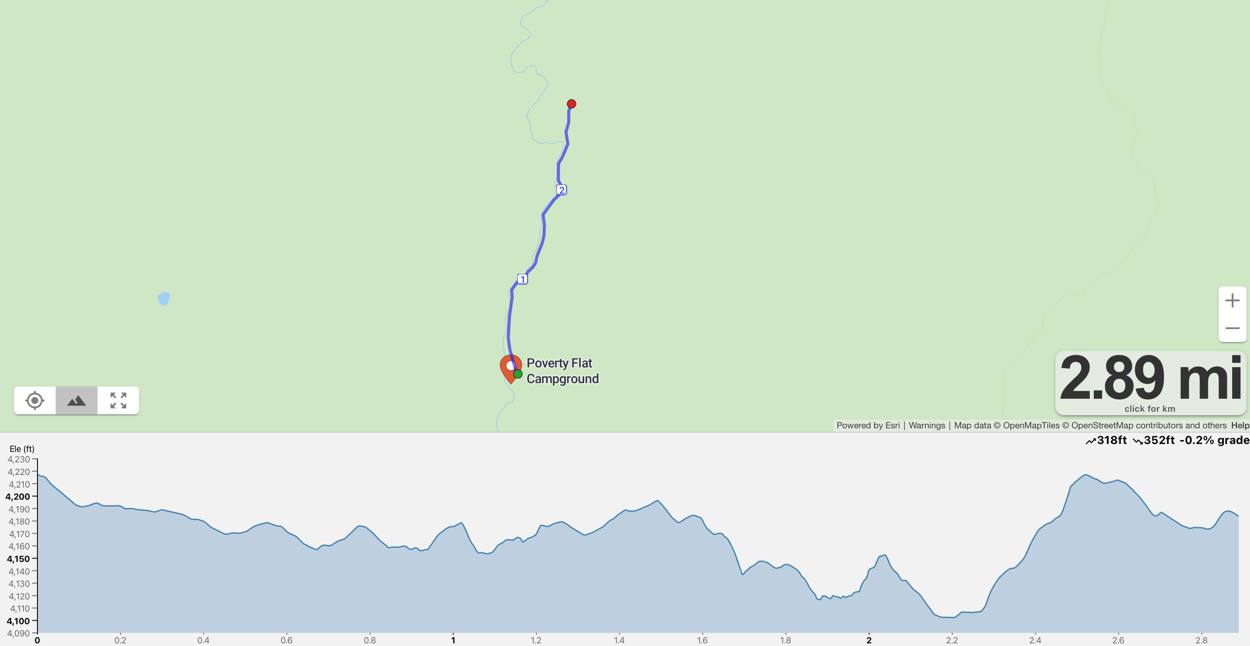
Leg 8 - 2.9 miles
Difficulty - Super Easy
This short and scenic 2.9-mile leg offers a relaxing break in the action. The route gently winds alongside the river, with views of calm waters and sandy bars lining the banks. It’s a peaceful stretch—perfect for settling into an easy rhythm and soaking up the natural beauty before the next challenge begins.
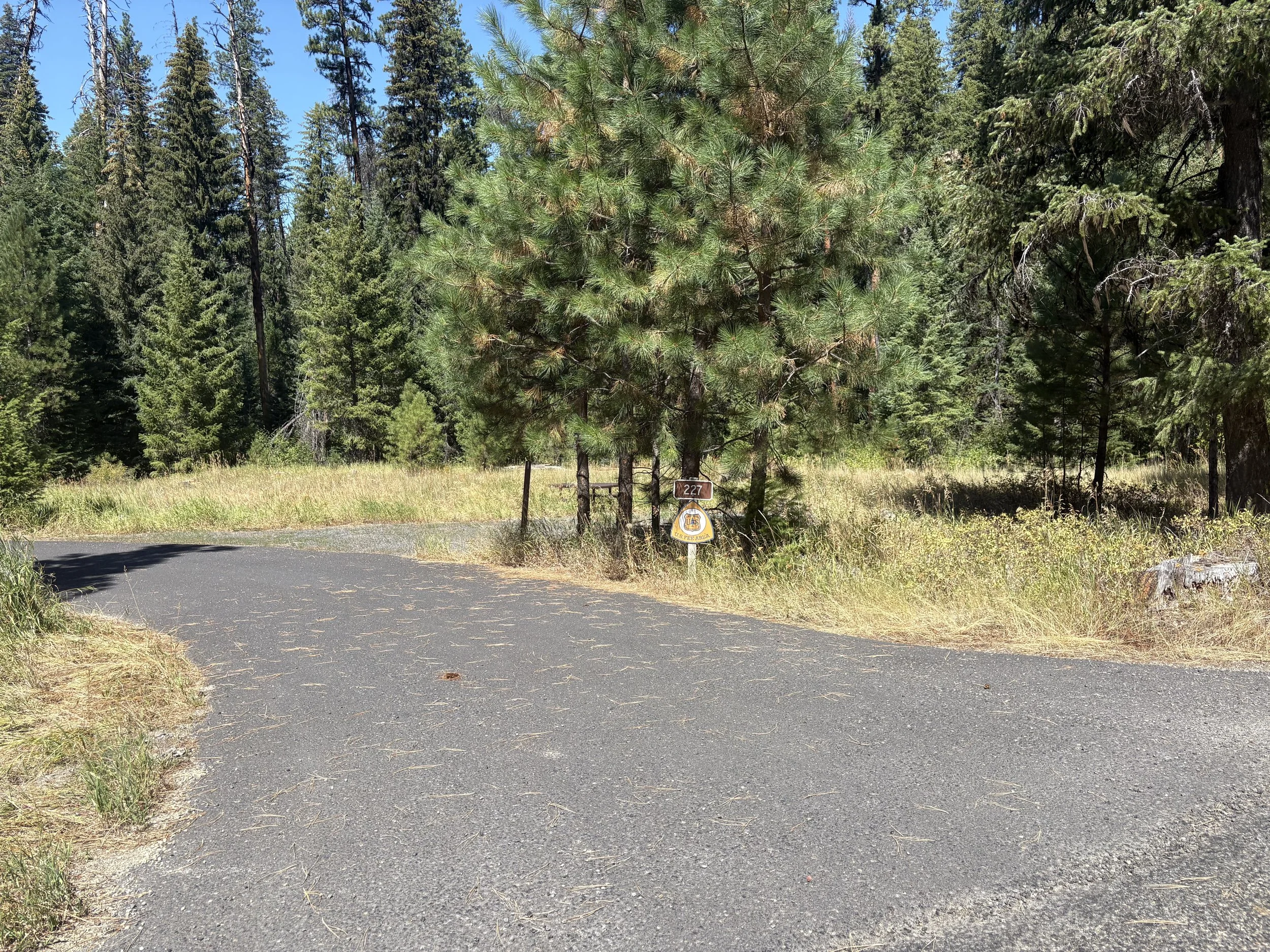
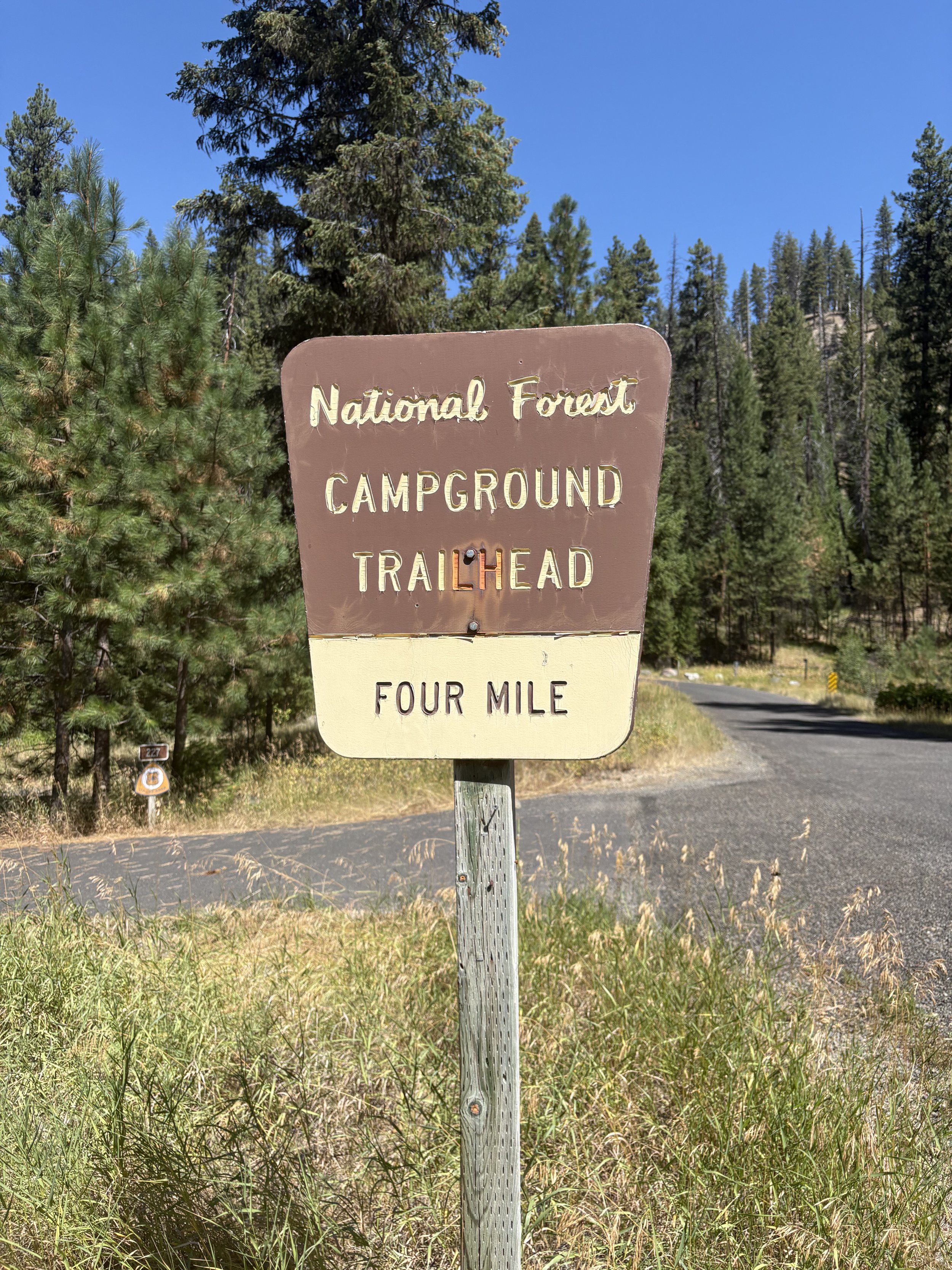
Exchange zone 8 Four Mile campground. Again you will need to pull into park and the exchange zone is on the road.
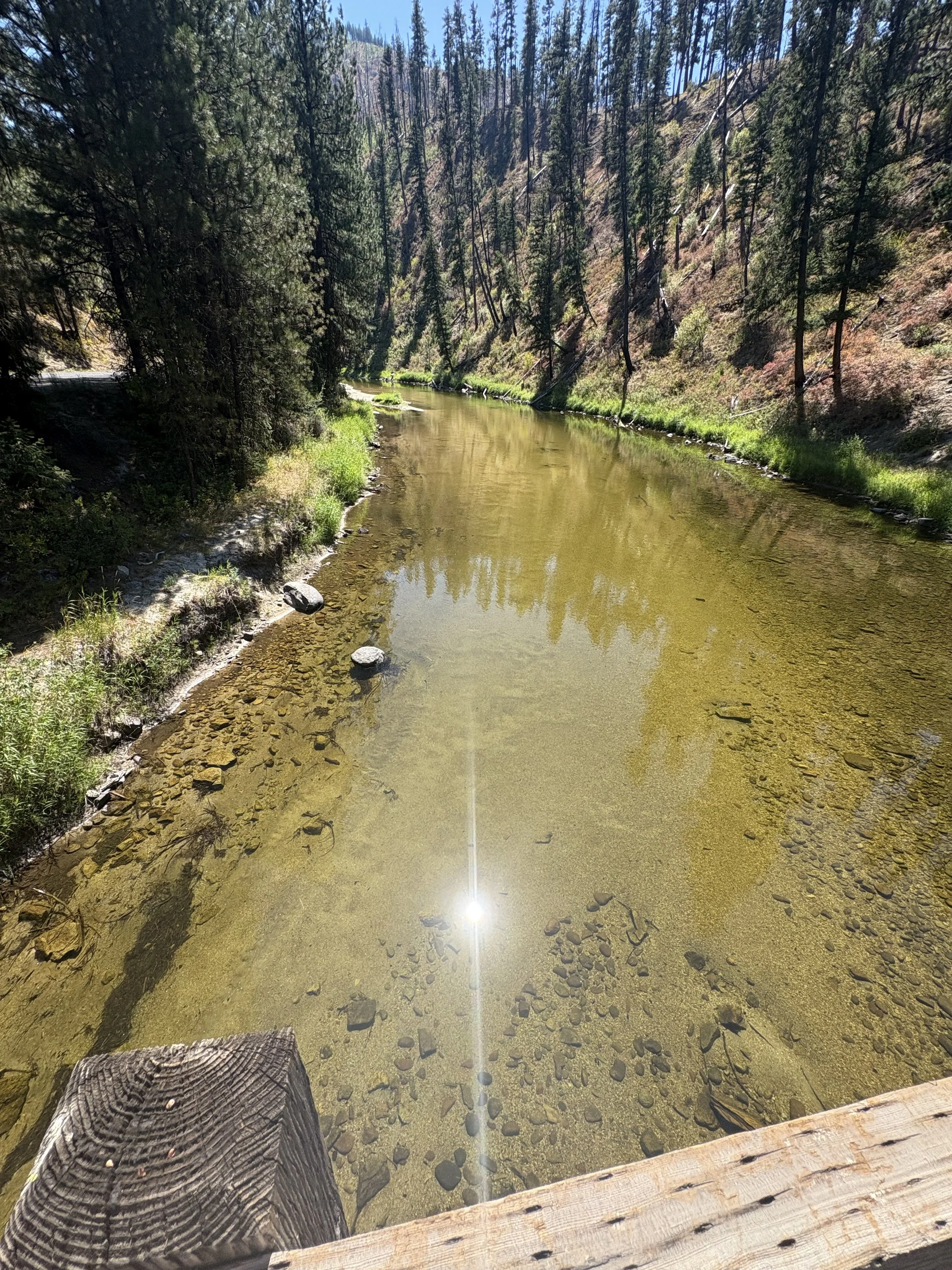
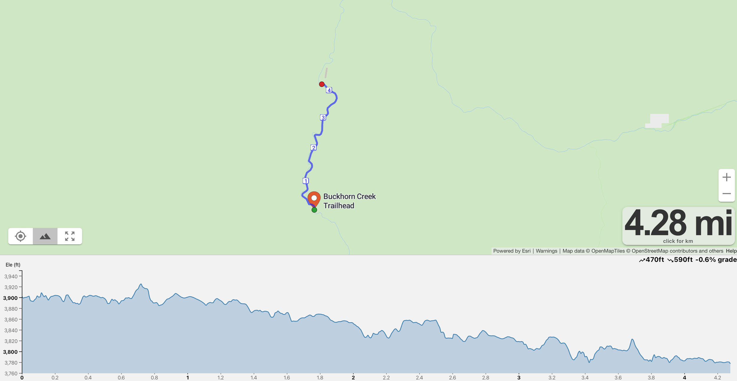
Leg 9 - 6.3 miles
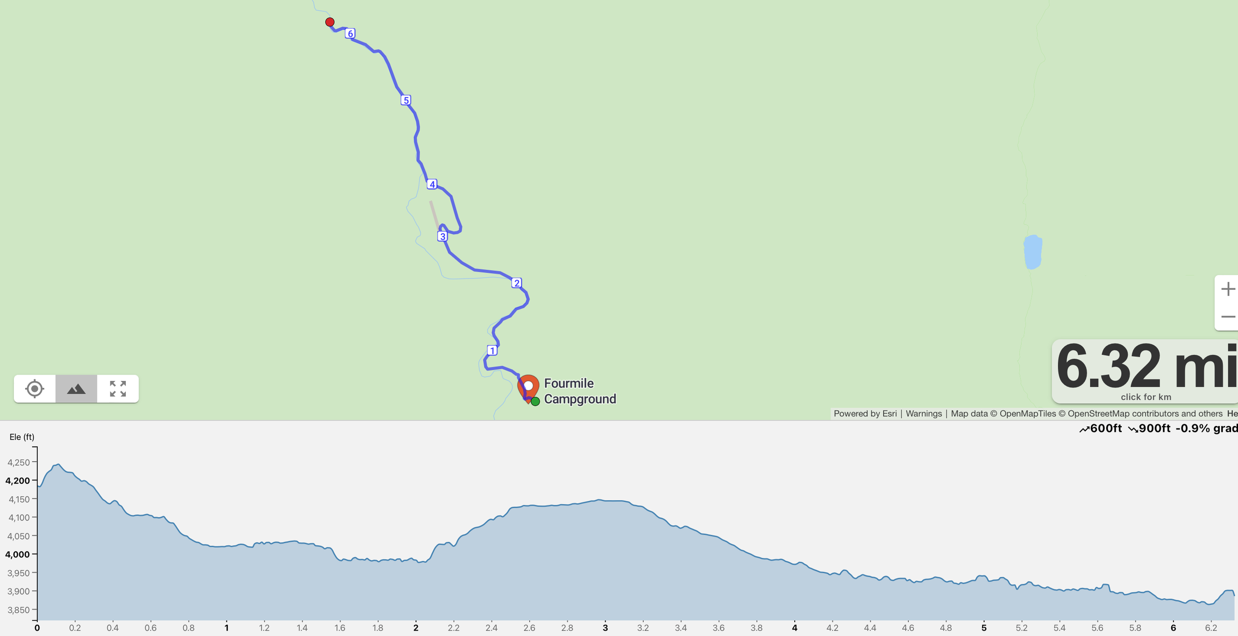
Difficulty - Medium
This 6.3-mile leg follows a winding road that hugs the river, offering constant views of flowing water and rugged canyon walls. It’s a rolling, peaceful route with a few shaded stretches and plenty of natural beauty.
Along the way, runners will find bathrooms at mile 3 near Reed Ranch Airstrip, and another set at mile 3.4 at Camp Creek—a rare mid-leg convenience.
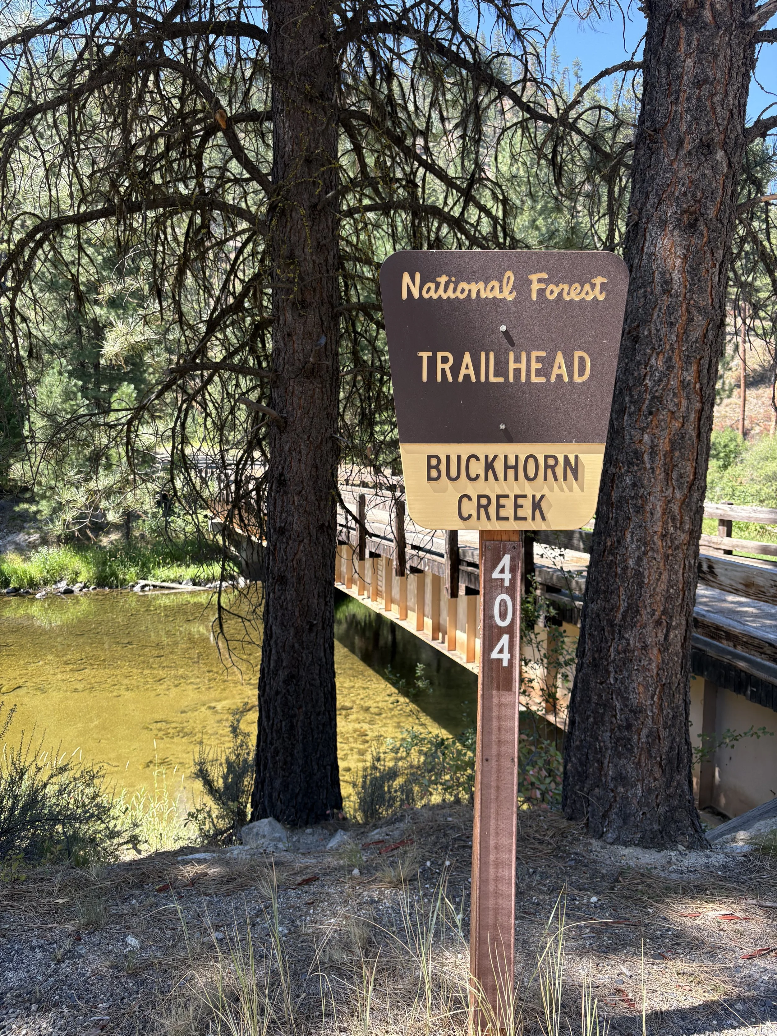
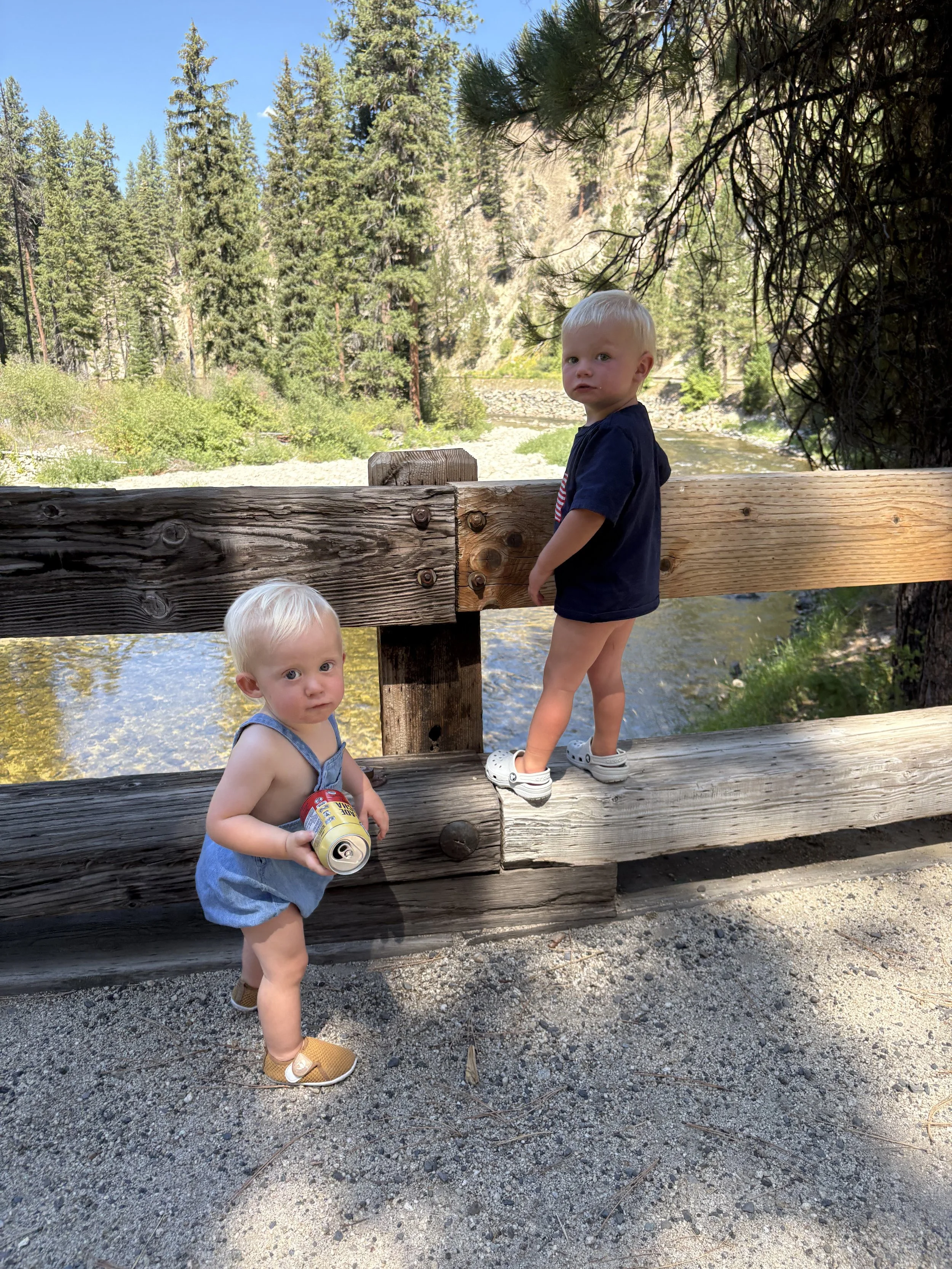
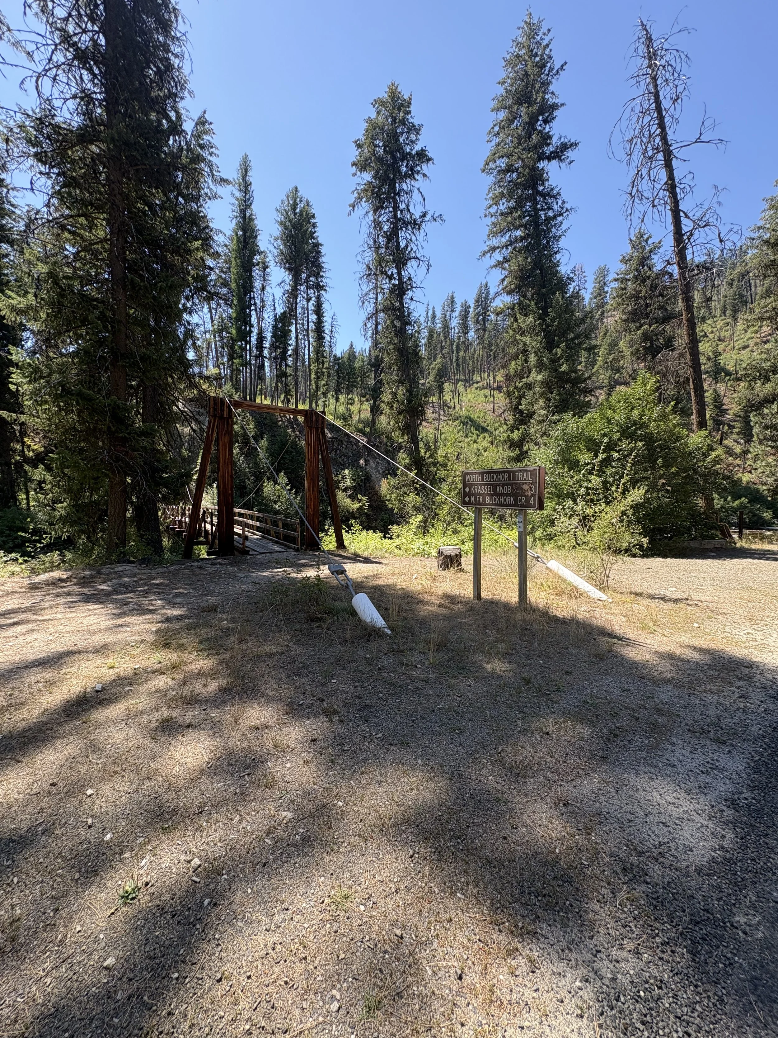
Exchange zone 9 is located at Buckhorn Creek Trailhead. Pull down the bridge to park or park on side of the road, the exchange zone is on the road near the bridge. Keep in mind this is a single lane bridge and having patience is key!
Though there are no bathrooms at the exchange zone, what it lacks in amenities, it makes up for in charm: just below the exchange lies a beautiful sandbar along the river, perfect for soaking tired legs and enjoying the cool water before the next push.
Leg 10 - 4.2 miles
Difficulty - Easy
This 4.2-mile stretch is pure flow—where gravity lends a hand and the river leads the way. Winding gently downhill with a series of smooth rollers, this leg is a runner’s dream: fast, fun, and full of good vibes.
You’ll cruise alongside the river on a mix of shaded paths and open stretches, with the sound of water nearby and the breeze at your back. Every downhill gives you momentum, and every curve keeps it interesting. It’s the kind of leg where you can settle in, let the effort ease, and just run.
Let the river set your pace, loosen up your stride, and enjoy this ride through nature’s version of cruise control. Your legs will thank you—and so will your teammates.
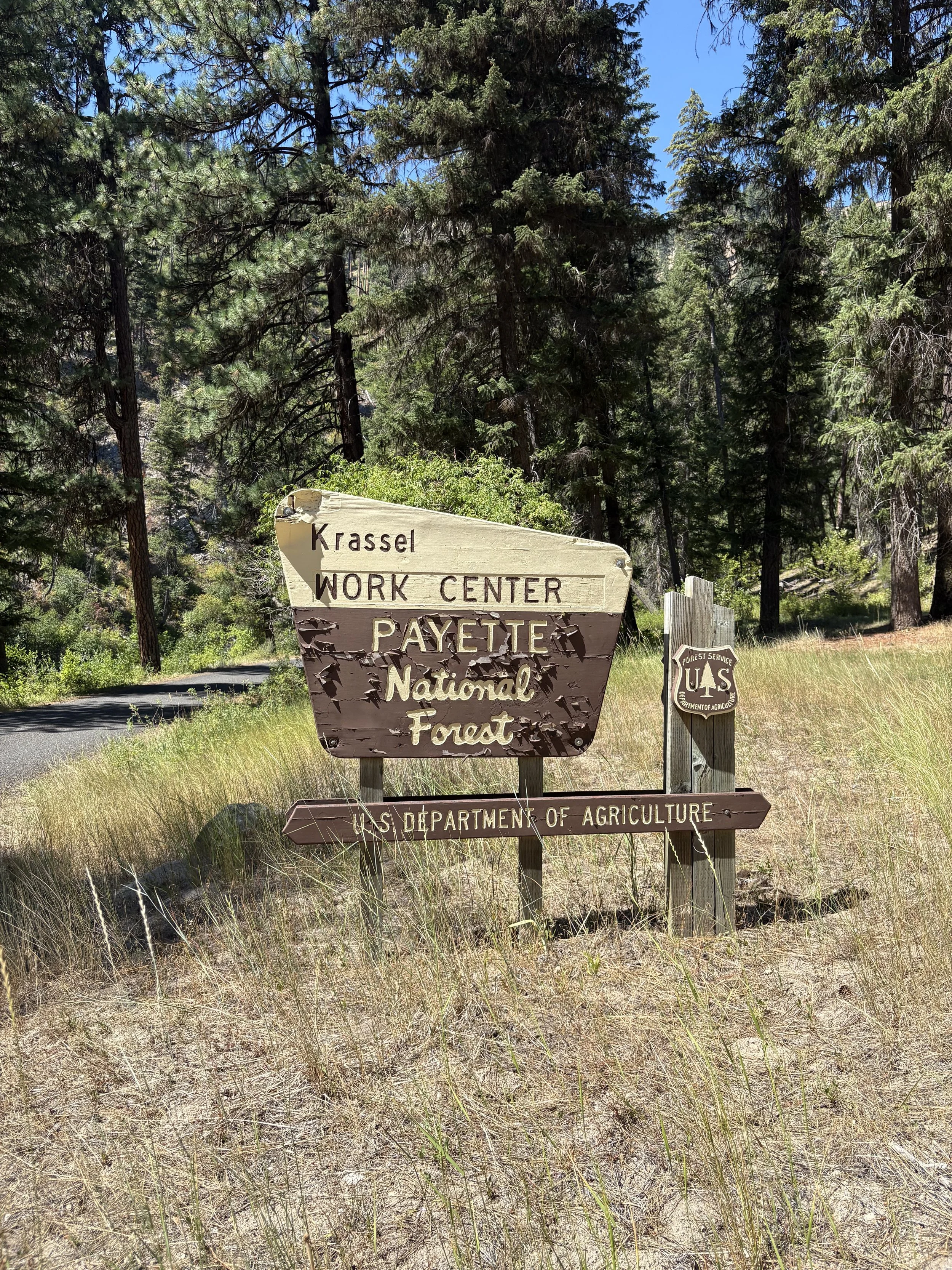
Exchange zone 10 is at bridge on left side of the road at Krassel work center.
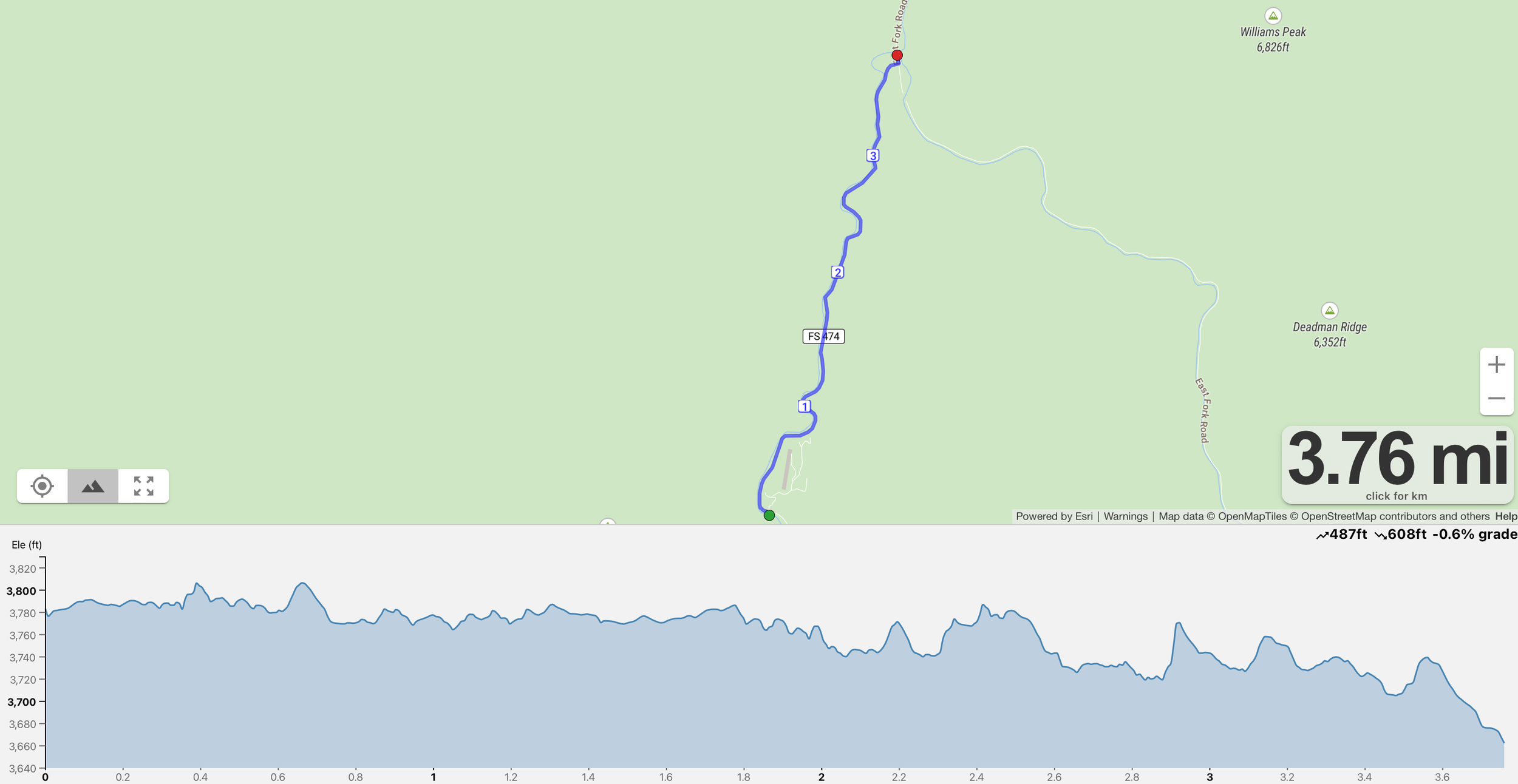
Leg 11 - 3.8 miles
Difficulty - Easy
This leg is a welcome breath of fresh air — a 3.8-mile easy stretch that hugs the banks of a peaceful mountain river. This leg is all about finding your rhythm and soaking in the scenery.
The route follows a mostly flat, gently winding road with smooth footing and minimal elevation gain. You’ll run alongside the sparkling river, surrounded by tall pines, cool air, and the steady sound of flowing water. It’s a perfect recovery leg or a fast cruise, depending on your pace.
Directions:
3.6 miles left onto E Fork Road / Lick creek Rd
Exchange zone 11 is right after the bridge you cross over at a trailhead on the left side of the road.
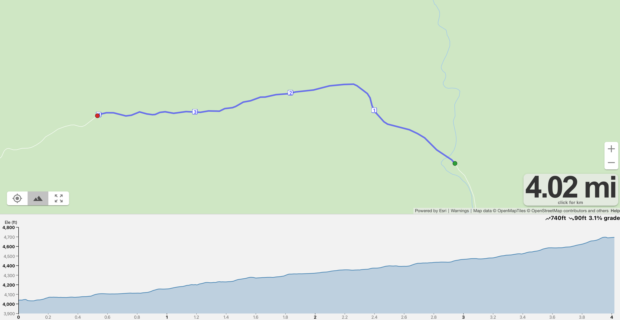
Leg 12 - 5.3 miles
Difficulty - Medium
This 5.3 miles of rolling uphill on a well-maintained dirt road that runs alongside a winding mountain river. The road is in good condition, making this leg runnable despite the gradual climbing, and the surroundings? Absolutely stunning.
You’ll follow the river’s path as it cuts through the forest, with massive granite boulders lining the banks and towering trees offering occasional shade. The peaceful rush of water keeps you company as you take on a mix of gentle inclines and short climbs that test your rhythm and resolve.
It’s a leg for runners who love flowing trails, clean footing, and beautiful backcountry energy.
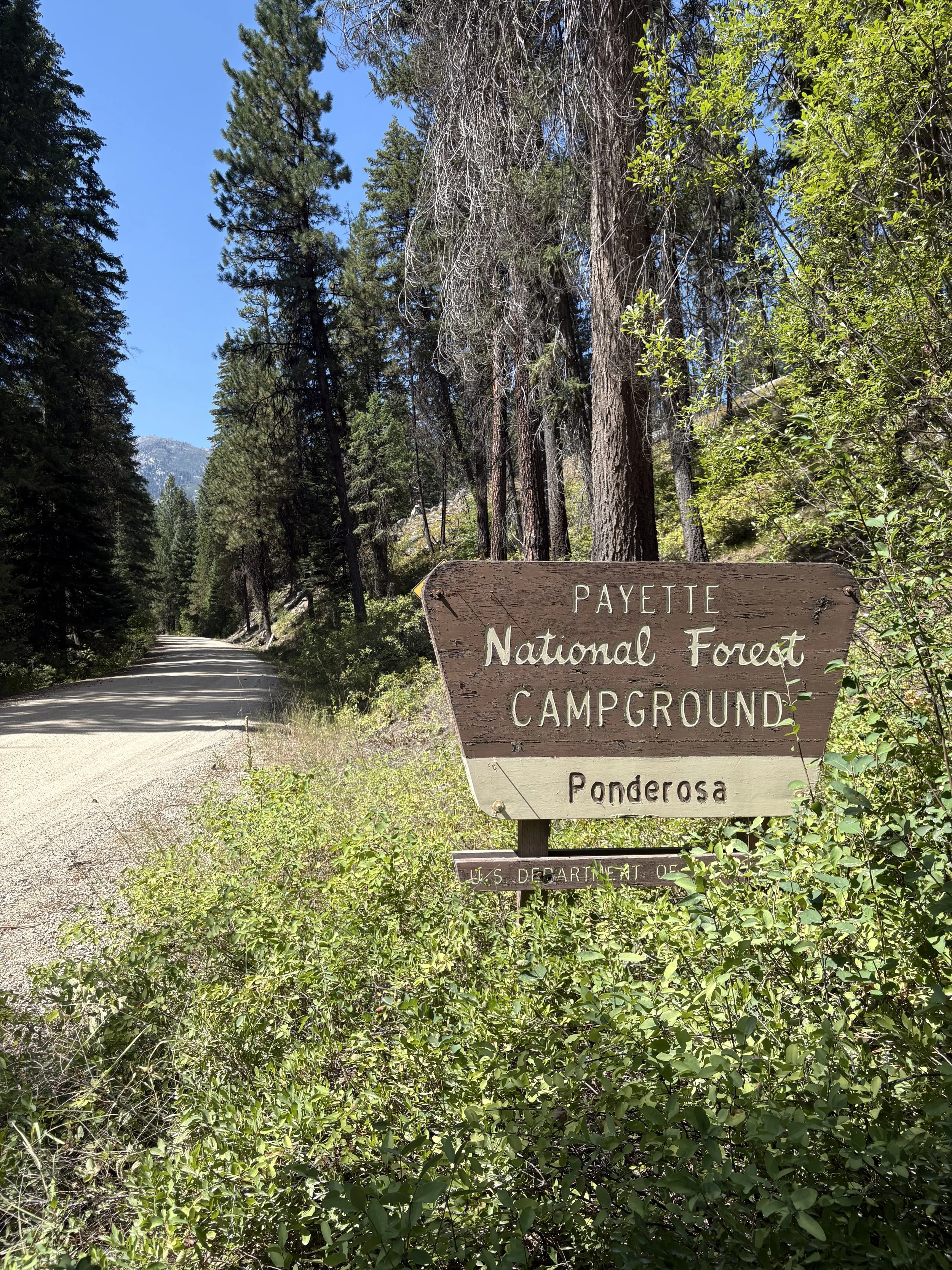
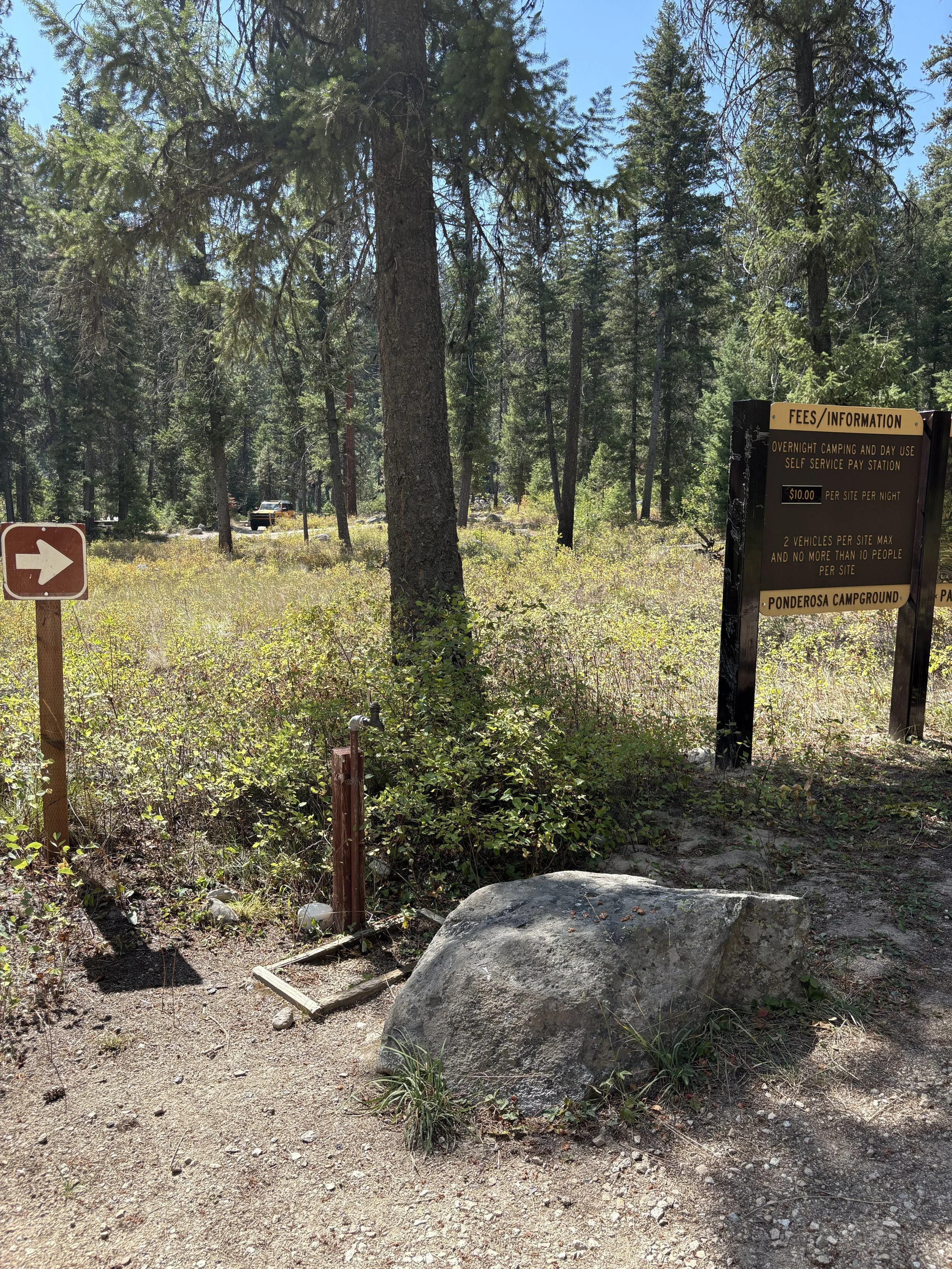
Exchange zone 12 is at Ponderosa campground, you will turn left into the campsite to find parking. The exchange zone is on the road. This campground does have a water spigot.
Leg 13 - 4 miles
Difficulty - Medium
Leg 13 begins peacefully near a beautiful, flowing river, with the cool shade of pine trees and the sound of water setting the tone. But don’t get too comfortable — the road tilts upward quickly, and from there, it’s a 4-mile grind to the summit.
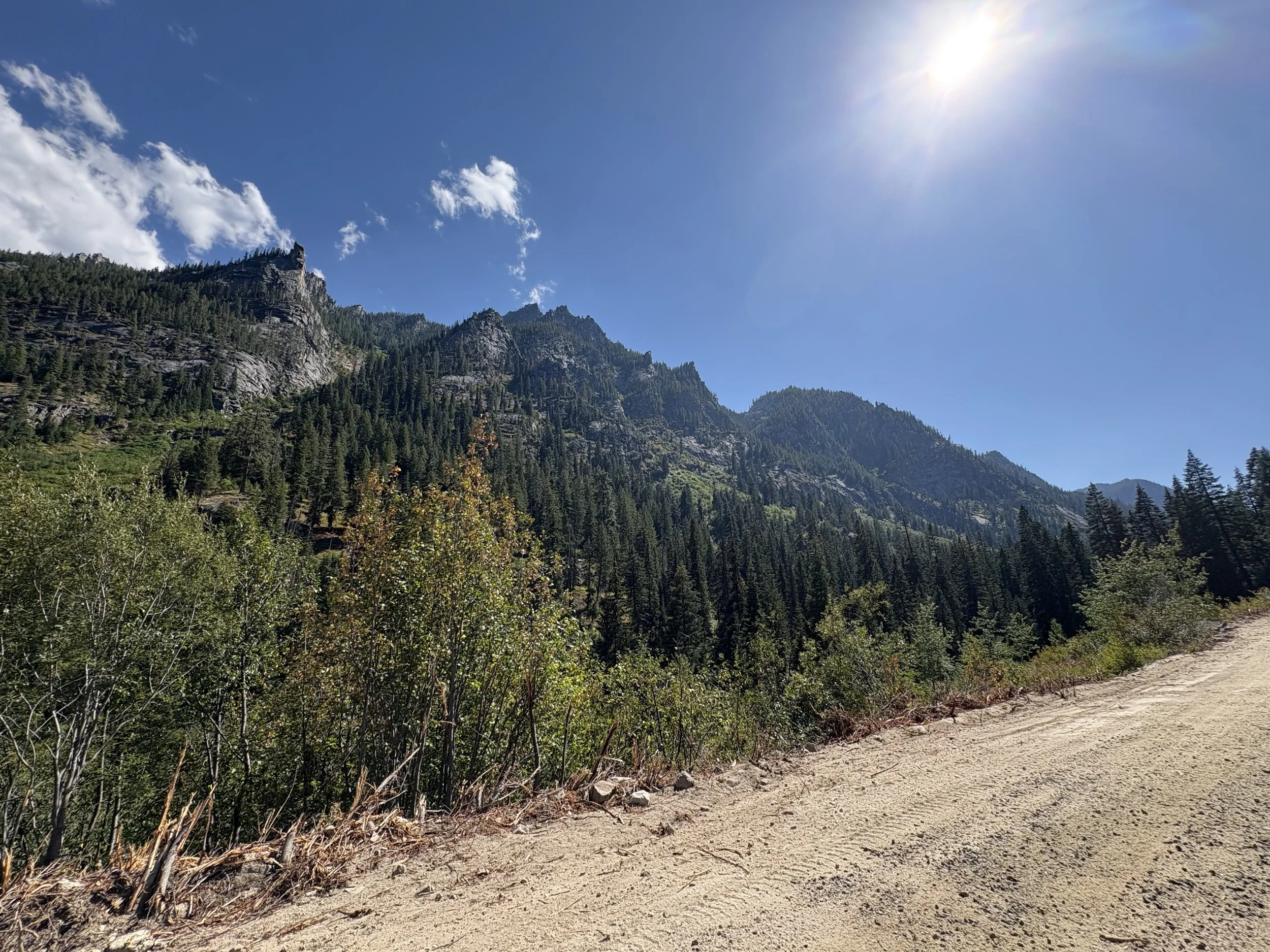
The first few miles offer shaded forest climbs on rugged dirt roads, but as you ascend, the trees thin and the views expand. The climb is steep, steady, and relentless — a true test of grit and pacing. Near the summit, the landscape opens up, revealing sweeping views of surrounding peaks and valleys.
This leg sets the tone for the entire race — bold, beautiful, and demanding.
Exchange zone 13 is a little sketchy, it’s a dirt pull out on the left side of the road, not a lot of room for parking, this is NOT the place to hang out. Drop em off and go!
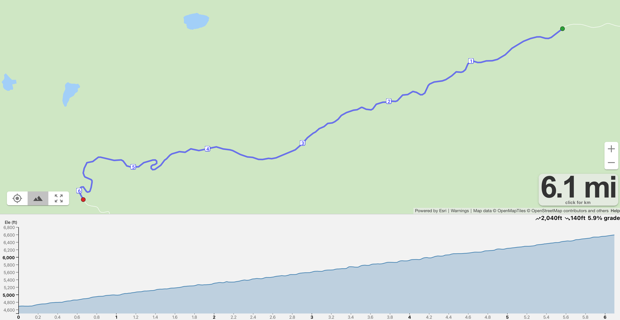
Leg 14 - 6.1 miles
Difficulty - HARD AF!
Welcome to the beast!
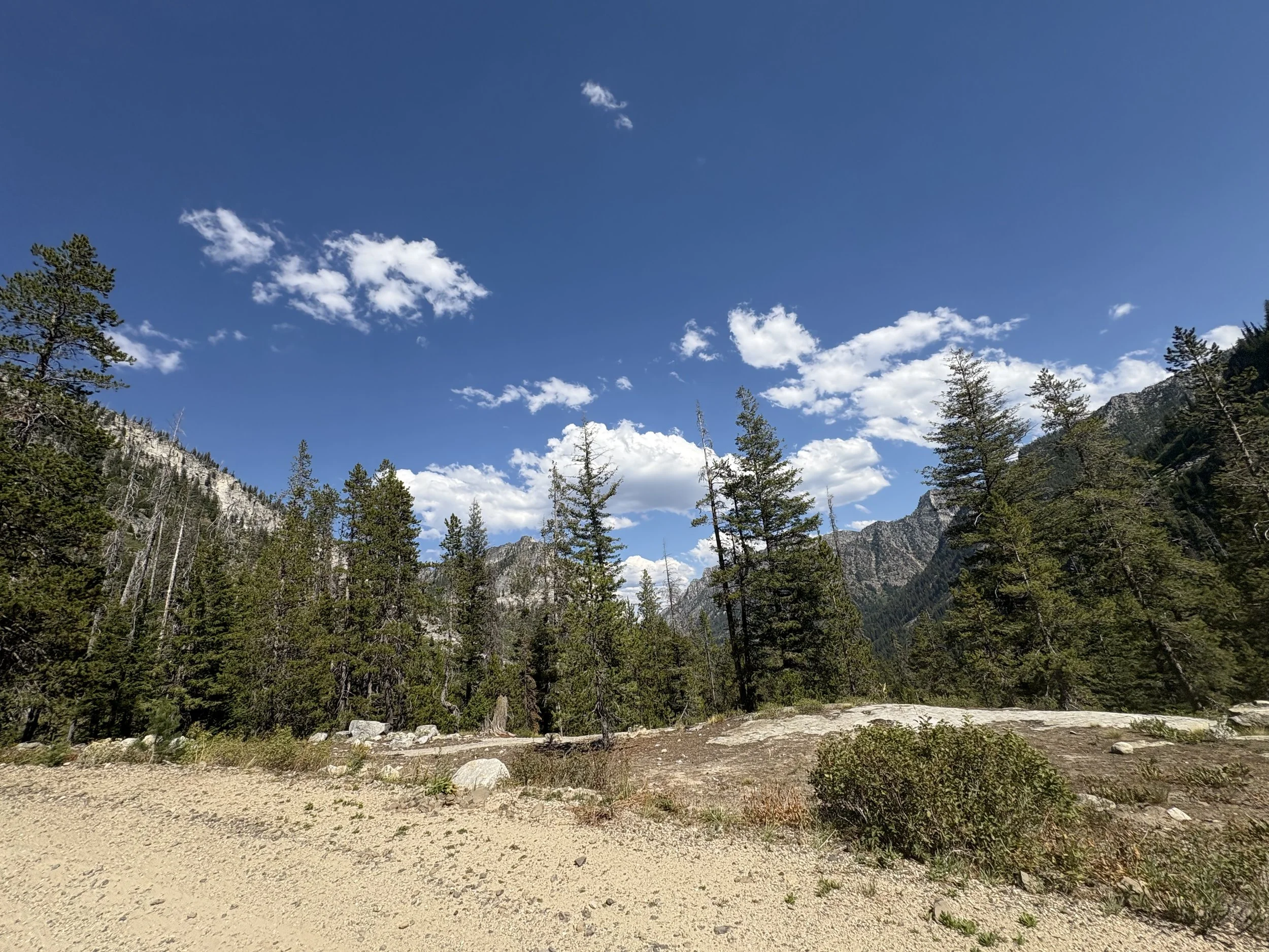
Leg 14 is the hardest climb of the Pine Pals Relay, a relentless 6.1-mile ascent that gains over 2,000 feet of elevation on rugged backcountry roads. This is where lungs burn, legs scream, and mental toughness takes over.
The trail winds steadily upward through thick forest, rocky outcrops, and exposed switchbacks, climbing toward the high point of the course. It’s steep, uneven, and totally unforgiving — but also unforgettable.
When you reach the top, you’ll be rewarded with panoramic views of alpine peaks, endless ridgelines, and the kind of summit moment that makes every step worth it.
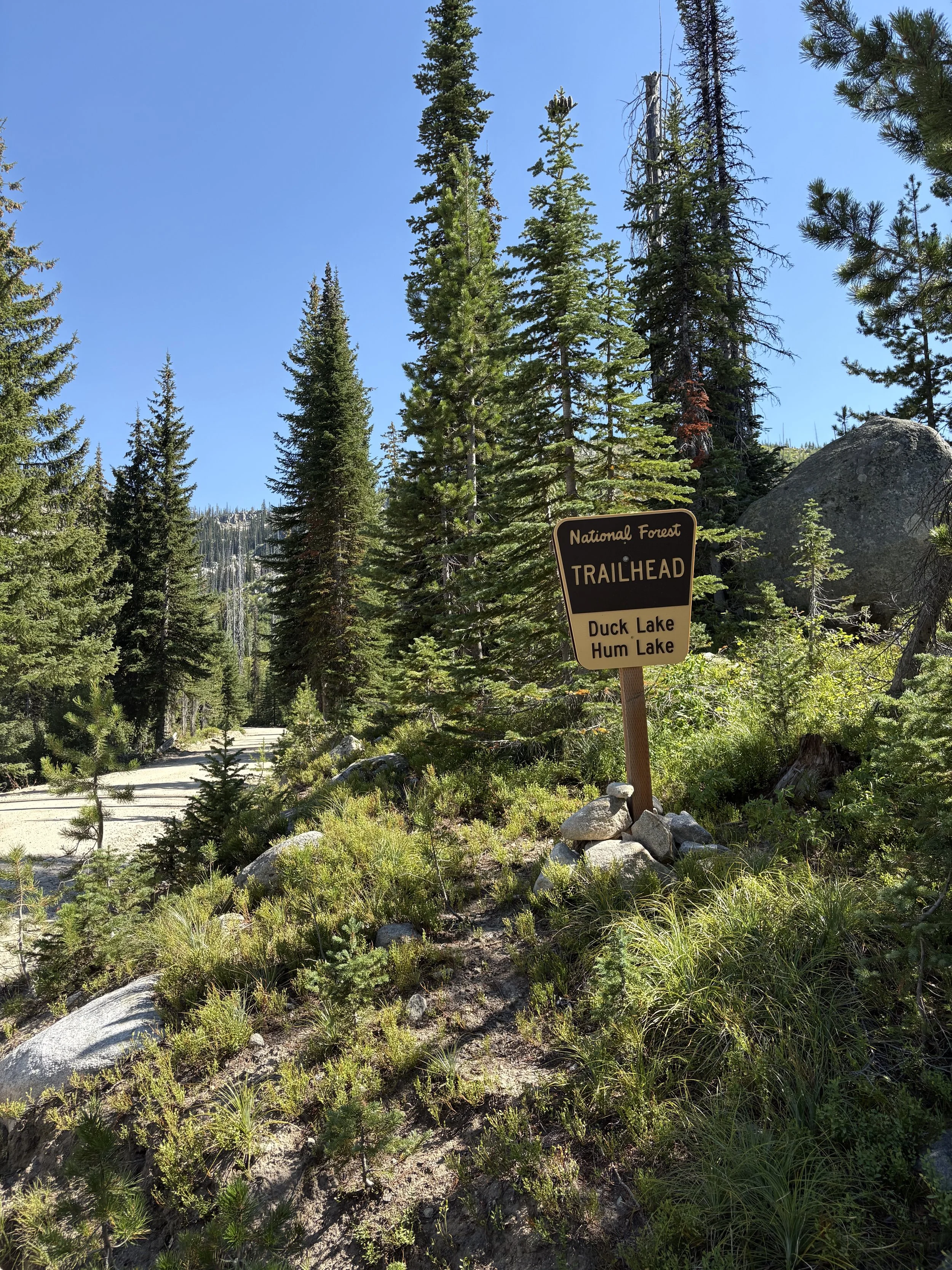
Exchange zone 14 is on the right at Duck Lake Hum Lake trailhead.
Leg 15 - 5.2 miles
Difficulty - Hard
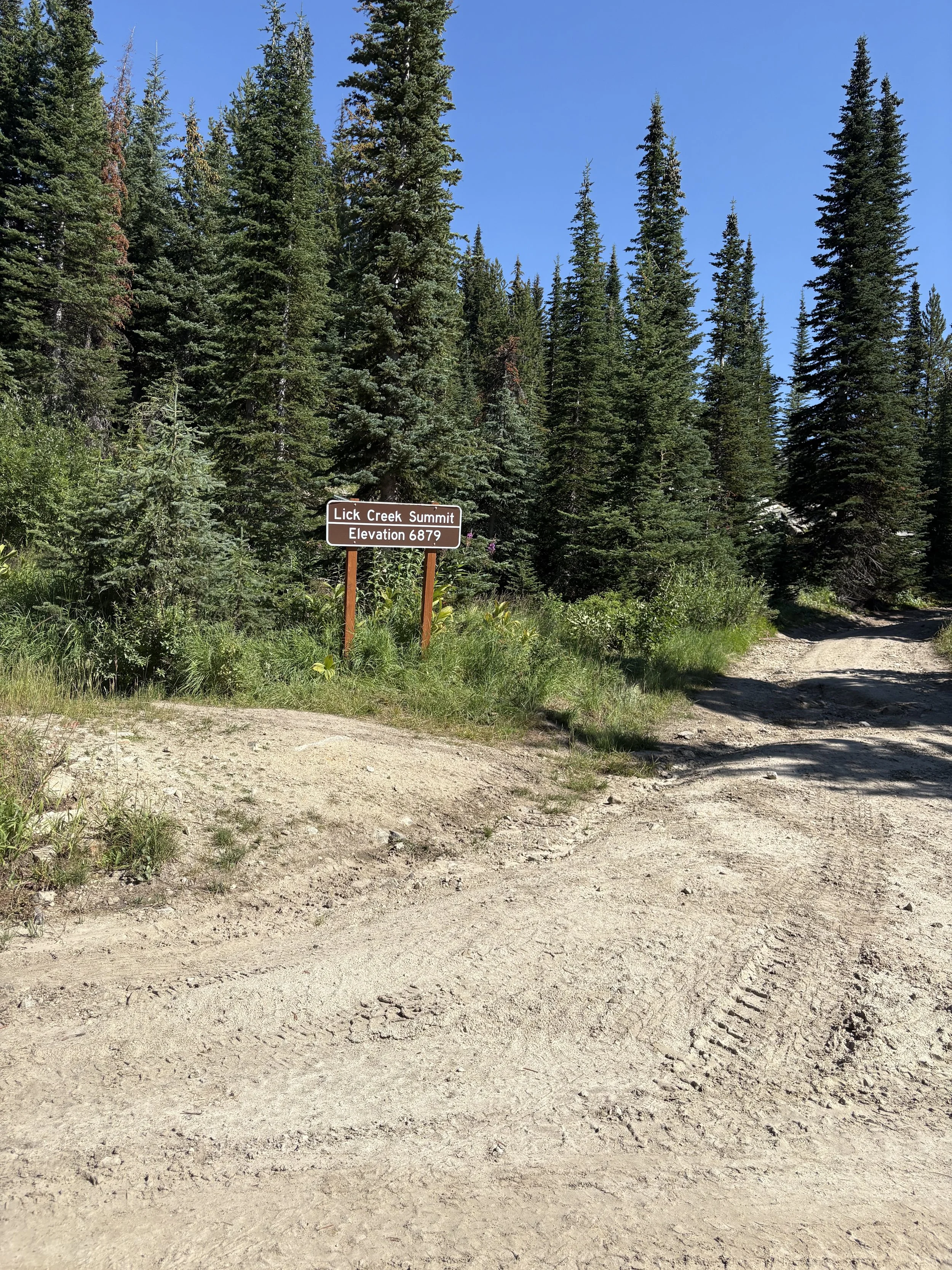
Leg 15 is not for the timid — it's short, steep, and wild.
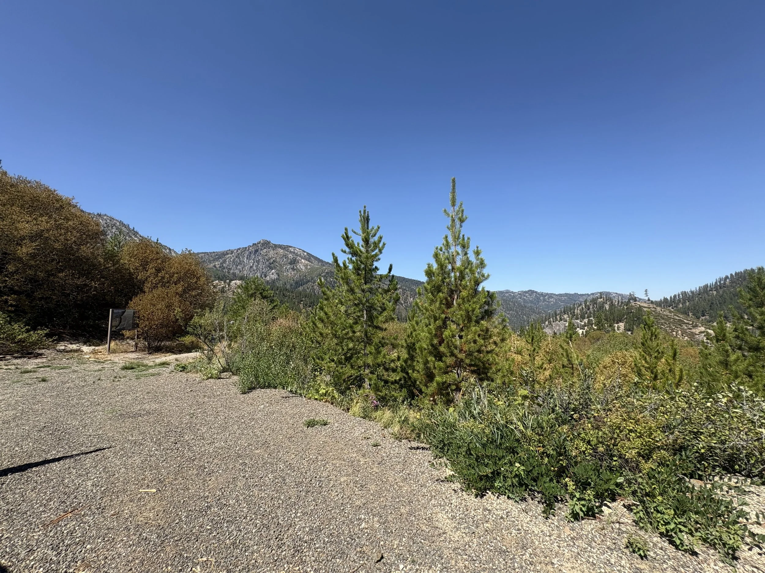
This leg kicks off with a tough, one-mile climb to the summit, rewarding you with stunning views of surrounding peaks. Once you conquer the ascent, the rest of the route delivers a fast and thrilling downhill finish. A perfect mix of grit and glide!
Cheering squad be sure to stop at Lick Creek Summit and enjoy the view and the effort it took to get there! Its ‘s all downhill from here!
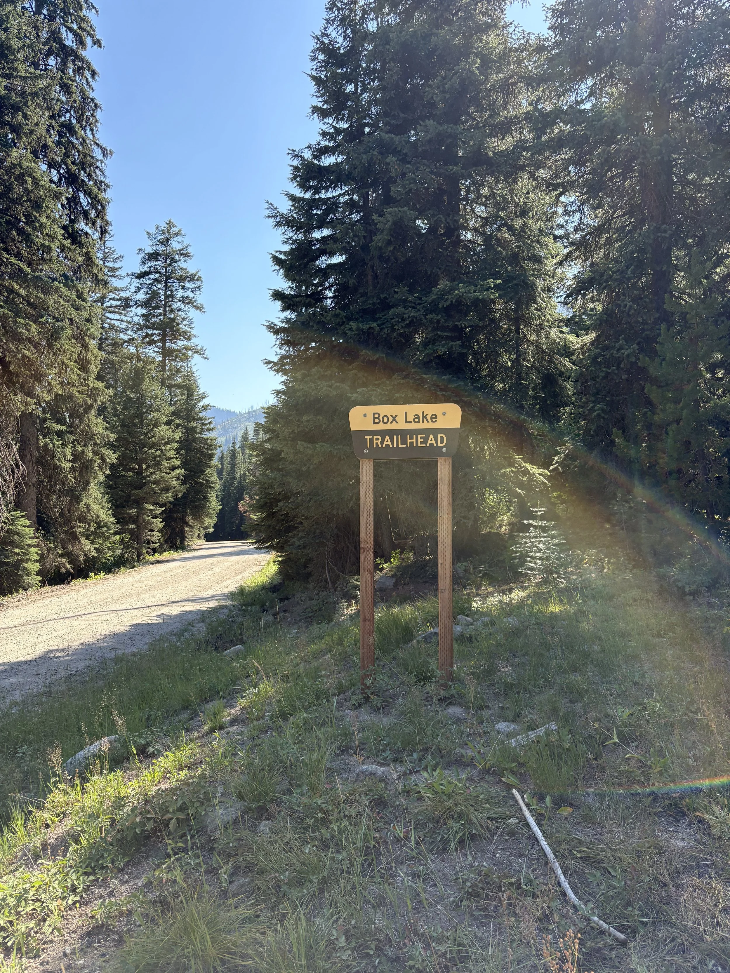
Exchange zone 15 is at Box Lake trailhead smaller dirt parking lot located on the right side of the road.

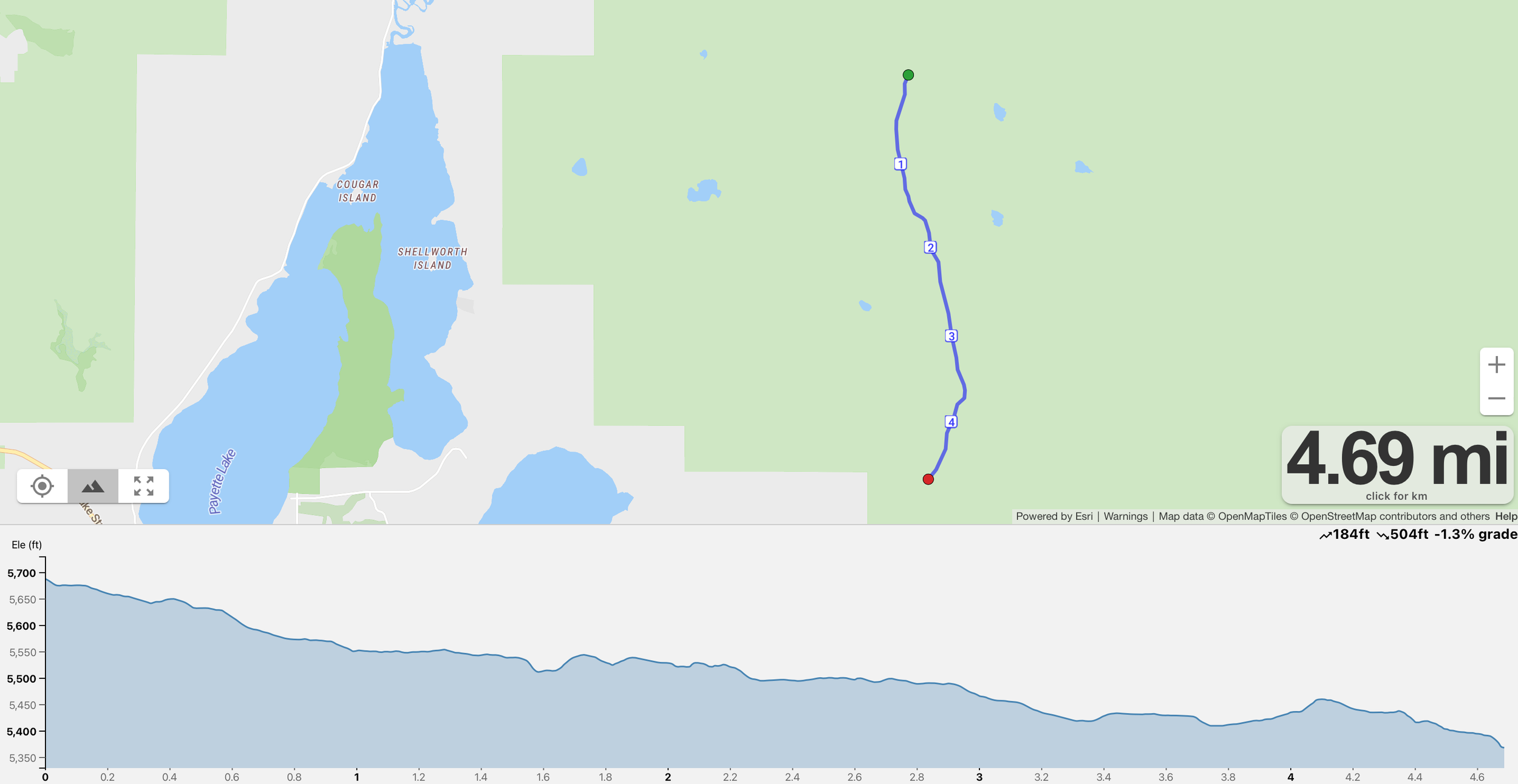
Leg 16 - 4.7 miles
Difficulty - Easy
Leg 16 is where the rhythm of the race meets the flow of the wild.
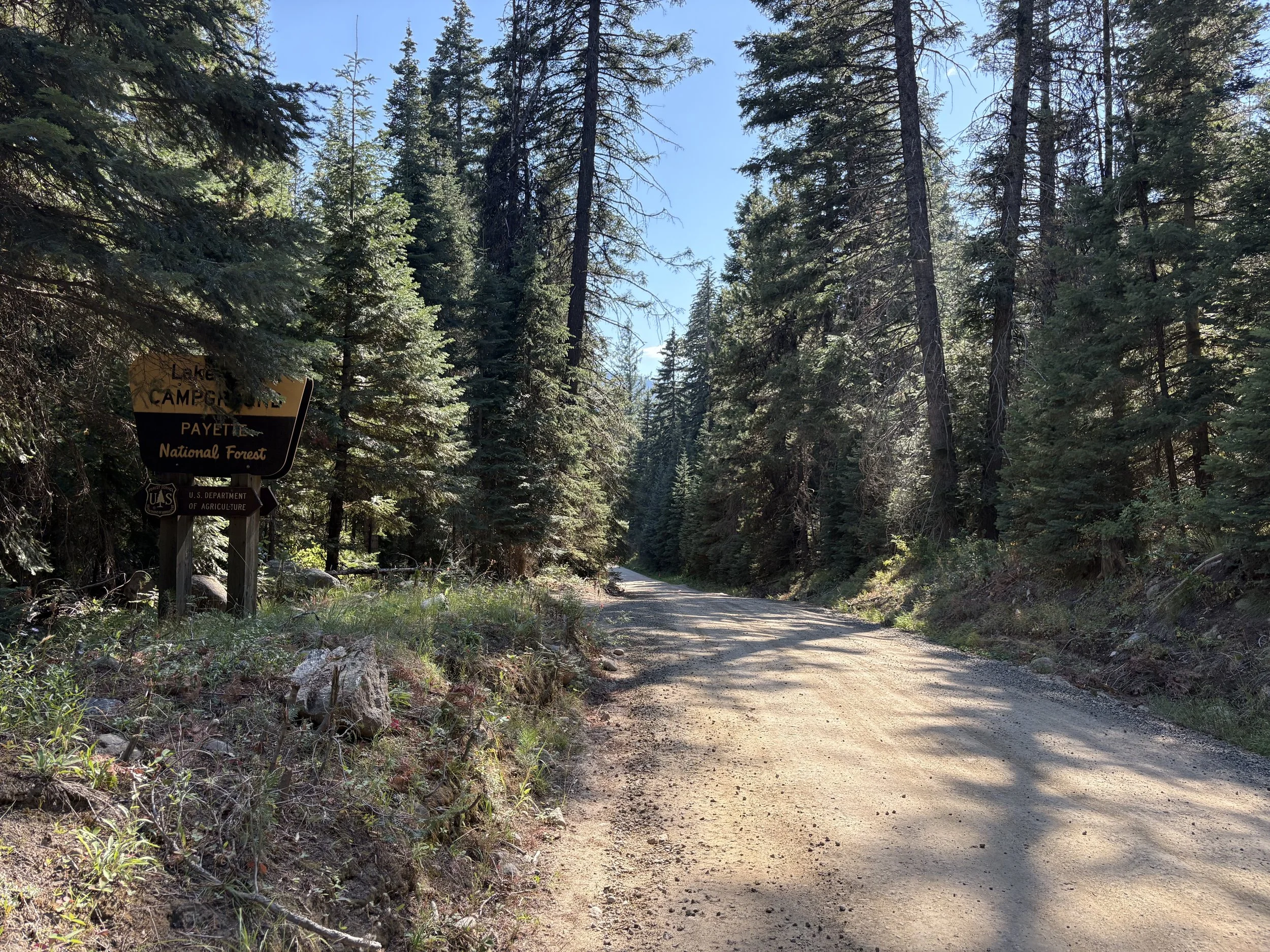
This leg is 4.7 miles of downhill fun, running alongside the scenic North Fork of the Lake Fork River. Runners will stop at the Lake Fork Campground sign, where the exchange point is located.
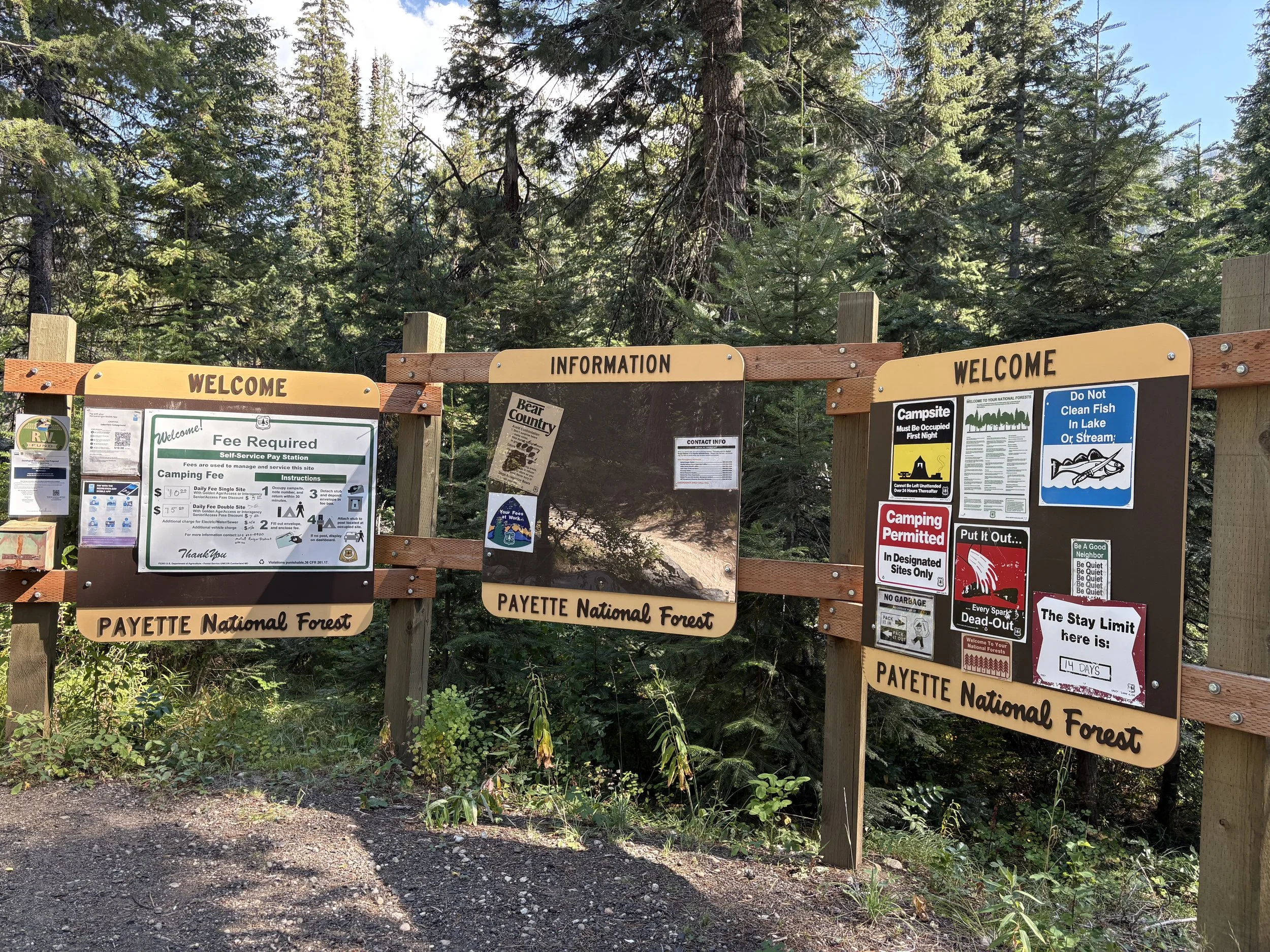
Exchange zone 16 is at Lake Fork Campground runners will stop on the road. Parking is 400 meters into the campground where there is access to water and bathrooms.
Leg 17 - 3.9 miles
Difficulty - Easy
Leg 17 is a beautiful and energizing segment of the relay, offering 3.9 miles of classic Idaho terrain. The route kicks off with a series of gentle rolling hills — enough to get your heart pumping but not enough to crush your spirit. You'll weave through open stretches and shady patches, surrounded by mountain air and the distant sound of creeks and birdsong.
But the best part? The final mile. You’ll descend into a lush pine forest, where the trail dips into a smooth, breezy downhill run, perfect for opening up your stride and flying into the next exchange
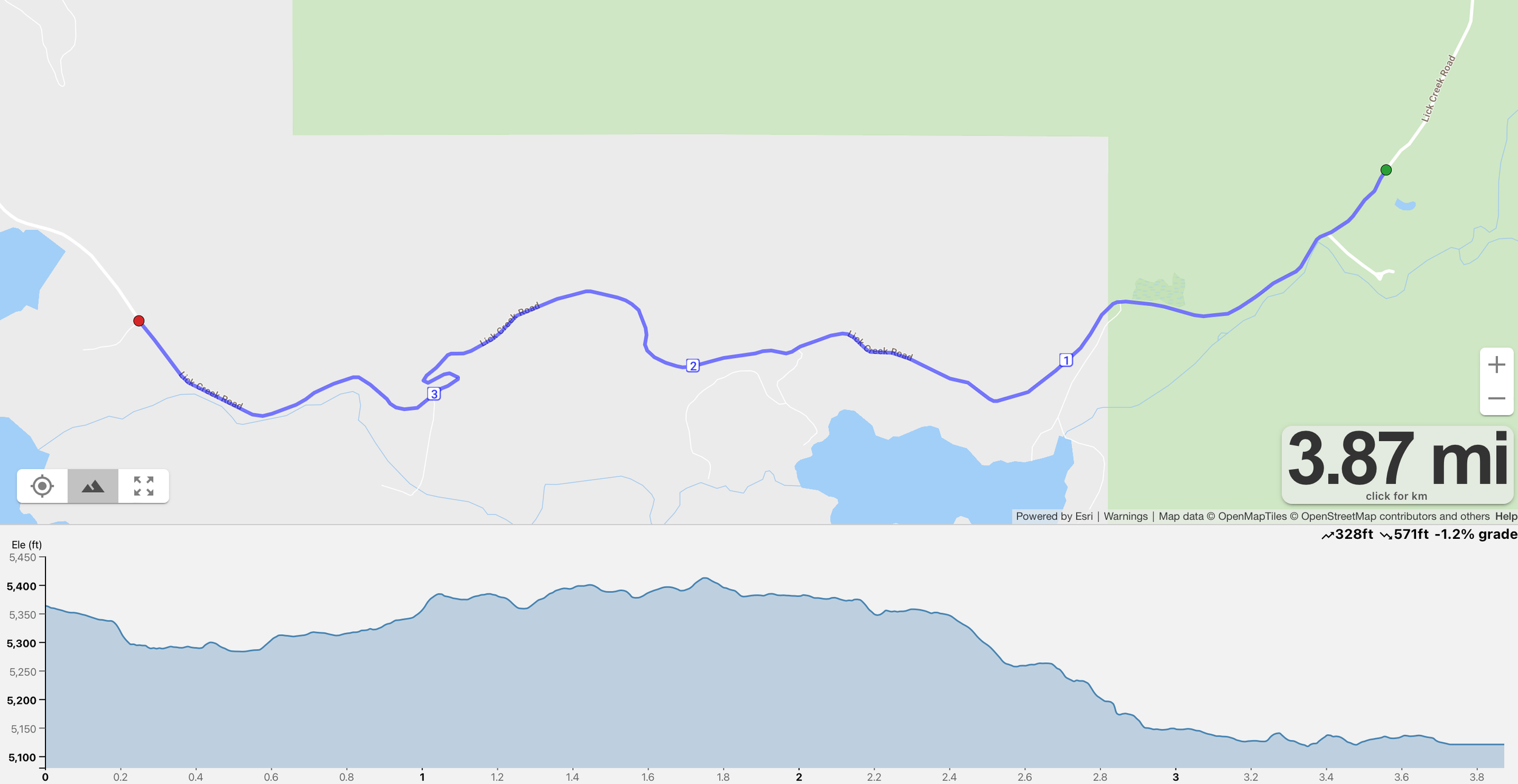
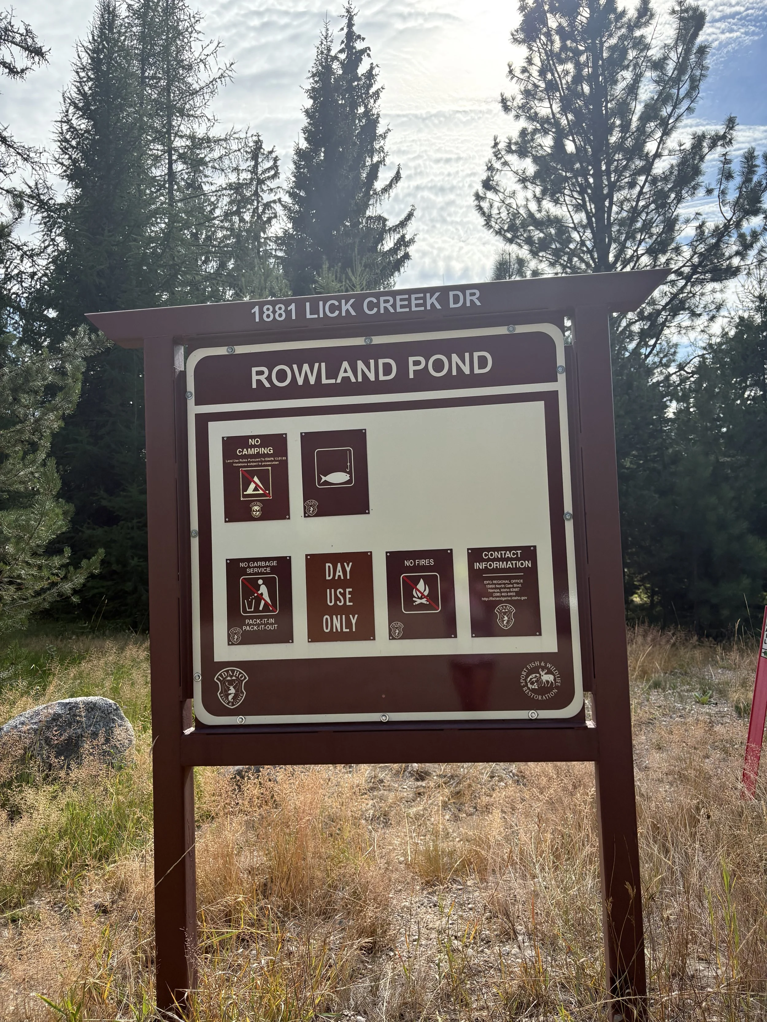
Exchange zone 17 is located on the left at Rowland Pond.

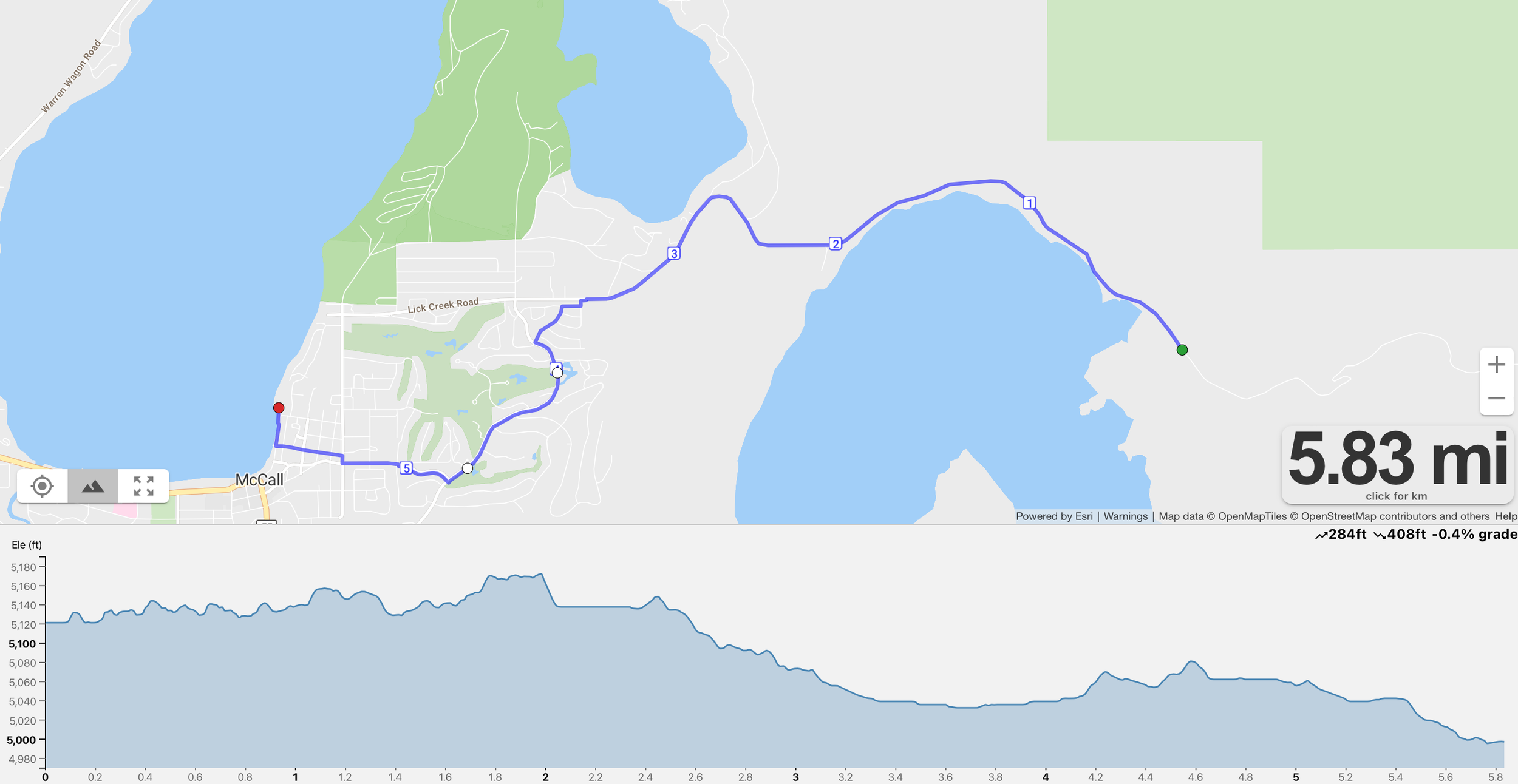
Leg 18 - 5.9 miles
Difficulty - Easy
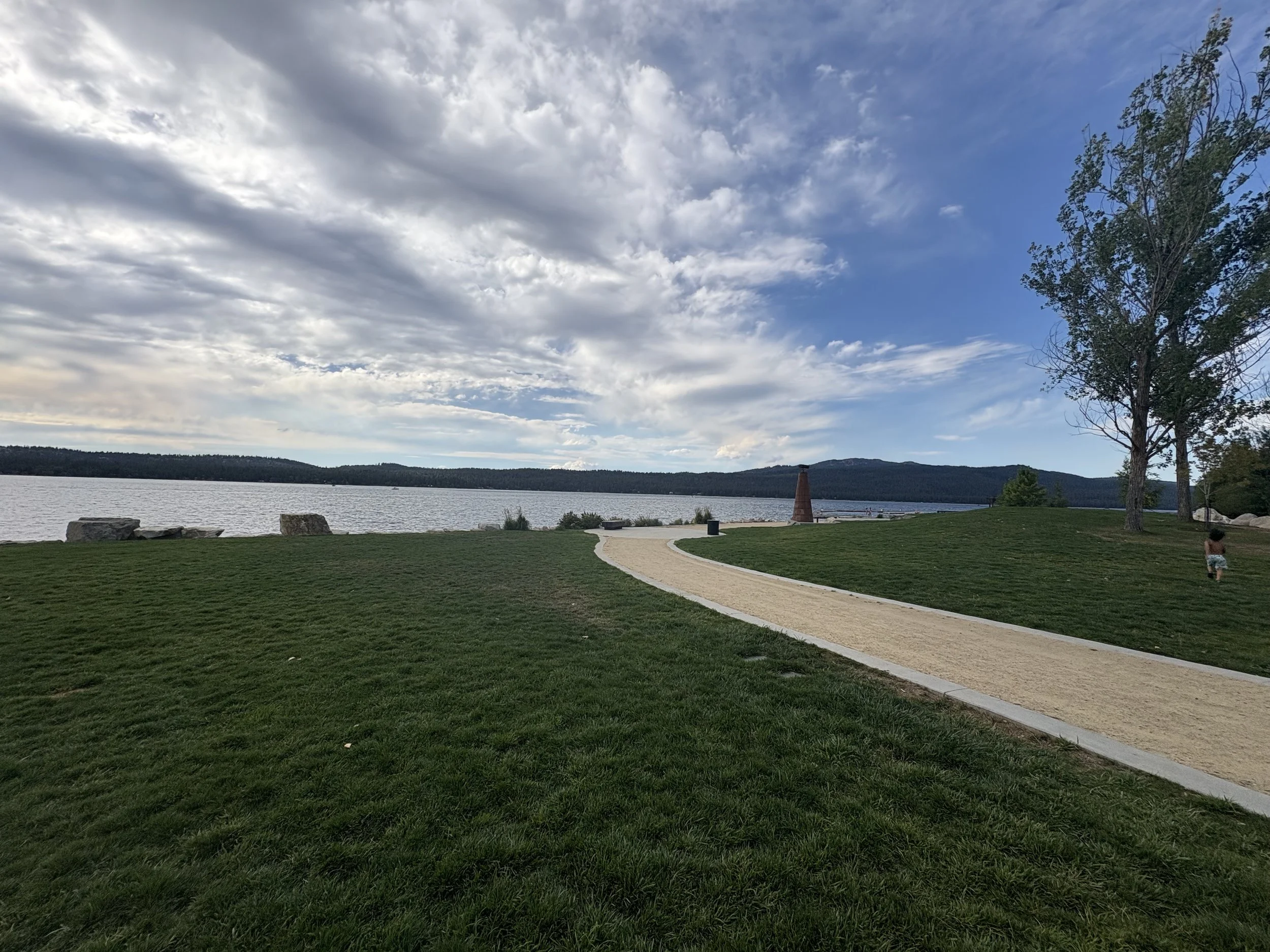
Leg 18 is a flat, fast, and scenic 5.9-mile stretch that starts along the peaceful shores of Little Payette Lake. After miles of tough mountain terrain, this final leg is a breath of fresh air — literally. You'll cruise on smooth backroads with lake views, open skies, and the energy of the finish line pulling you forward.
The route winds gently toward town, where you'll pick up the pace as you run through downtown McCall, cheered on by locals and teammates. The leg finishes in classic Idaho style — with a final sprint along the edge of Payette Lake, crossing the line into a lakeside celebration you won’t forget.
Directions:
Slight left onto Lick Creek Road
3.8 miles Left onto Spring Mountain road stay on bike path
1.2 miles Right onto Wooley Ave (narrow shoulder on road)
Continue lightly right it becomes Lenora St
Continue toward the lake it turns into Pine St
Left onto Lake St
FINISH!!